Spatial distribution of groundwater quality using geostatistical techniques in GIS.
تفاصيل العمل

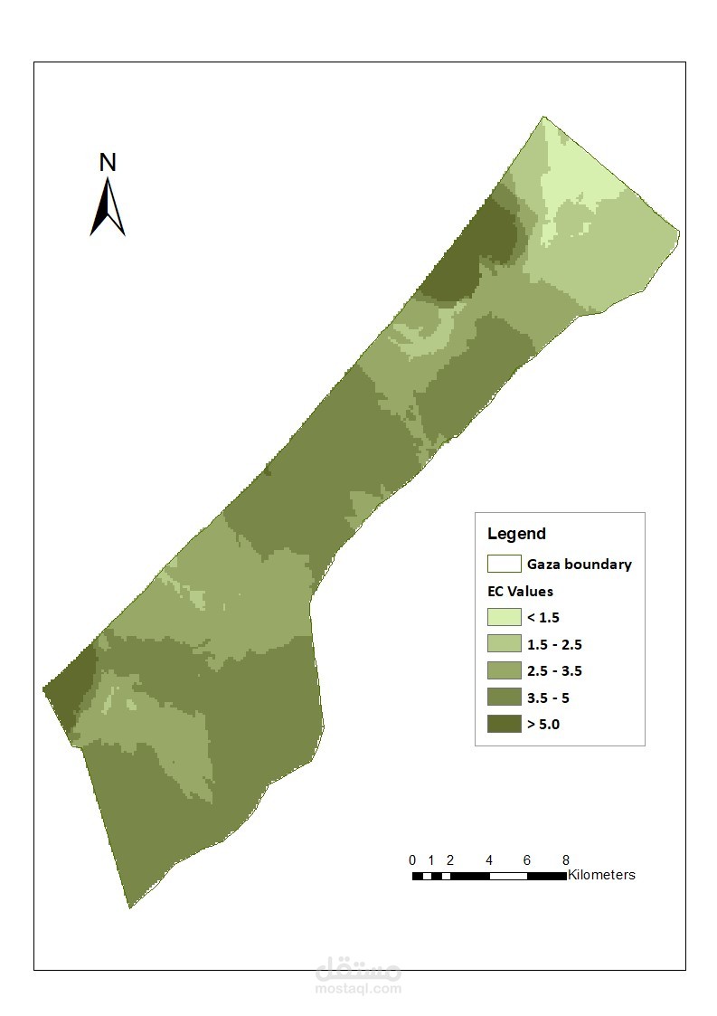
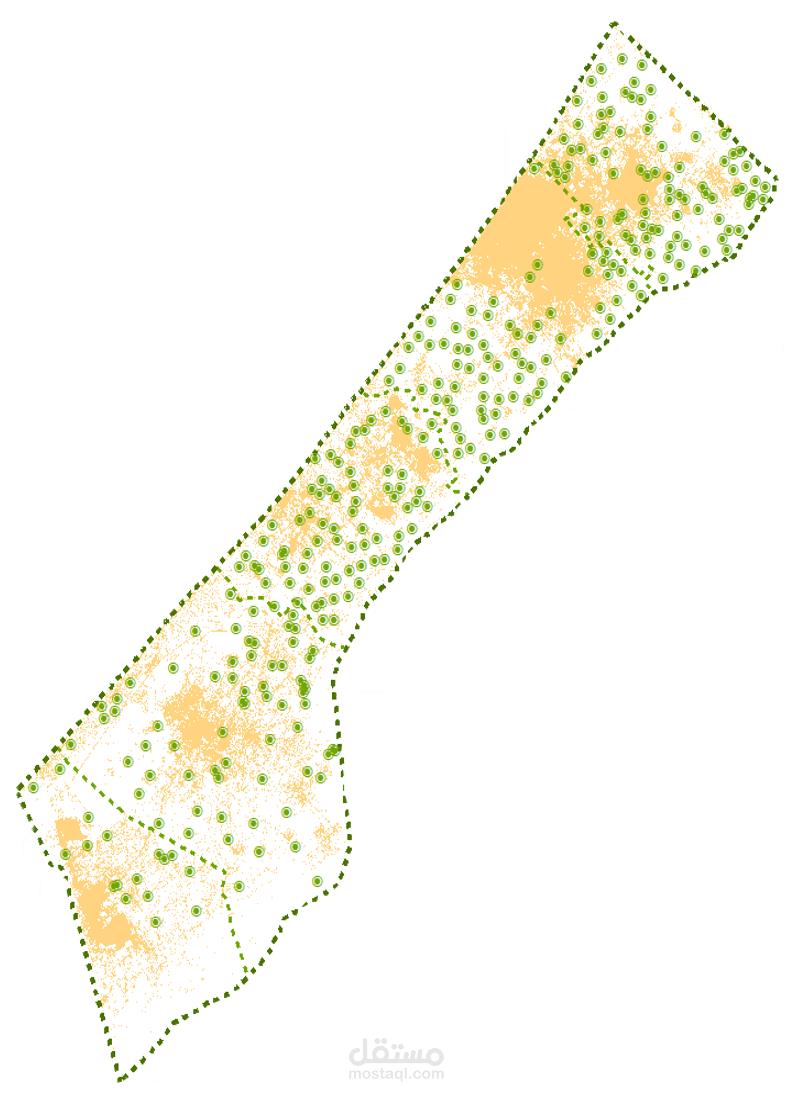
Spatial distribution of groundwater quality in terms of TDS was carried out using geostatistical techniques in [GIS]. Interpolation method was used to obtain the spatial distribution of groundwater quality over the area.