Egypt Birth Data Analysis and Geographic Visualization
تفاصيل العمل
Project Overview
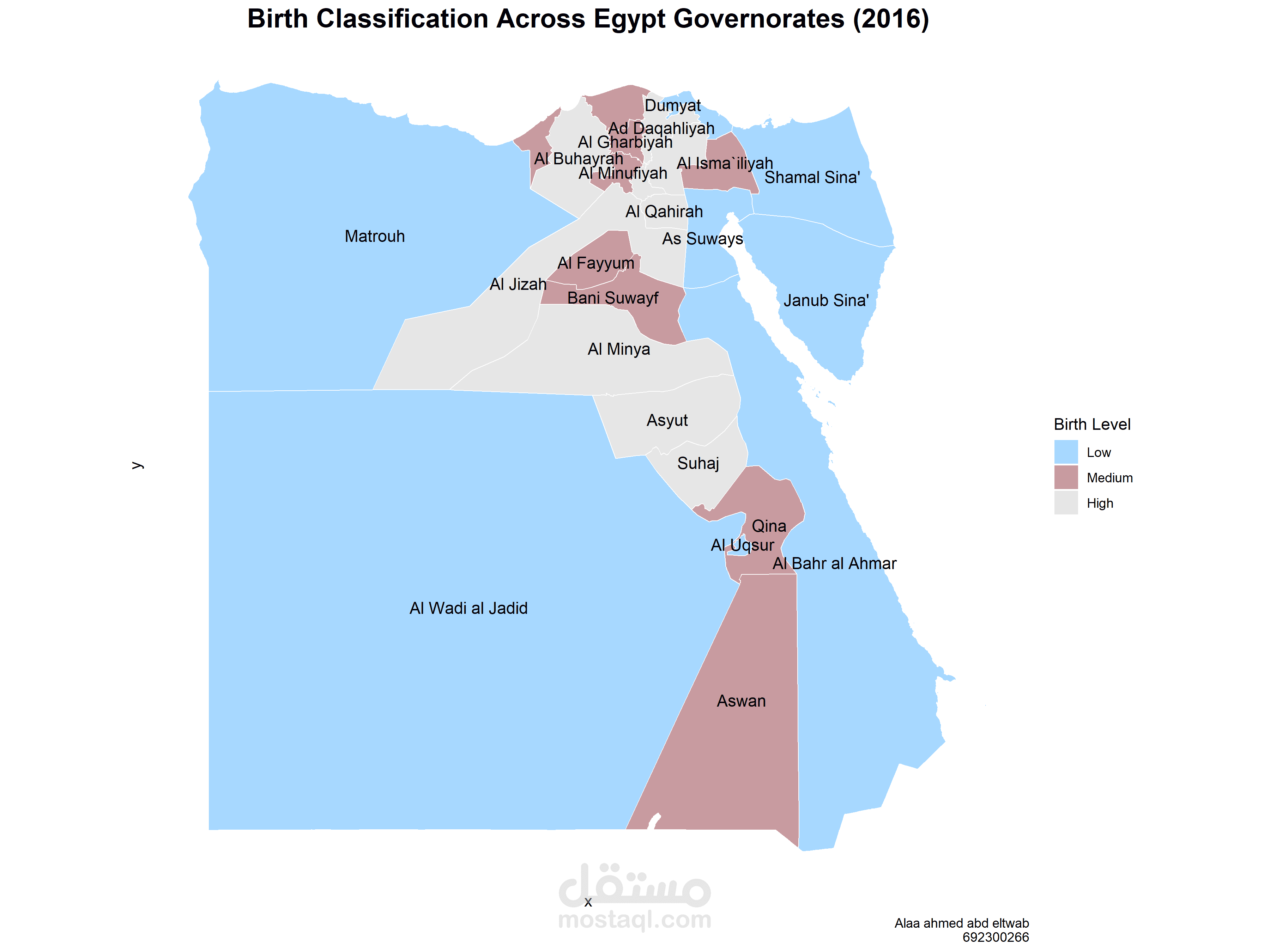
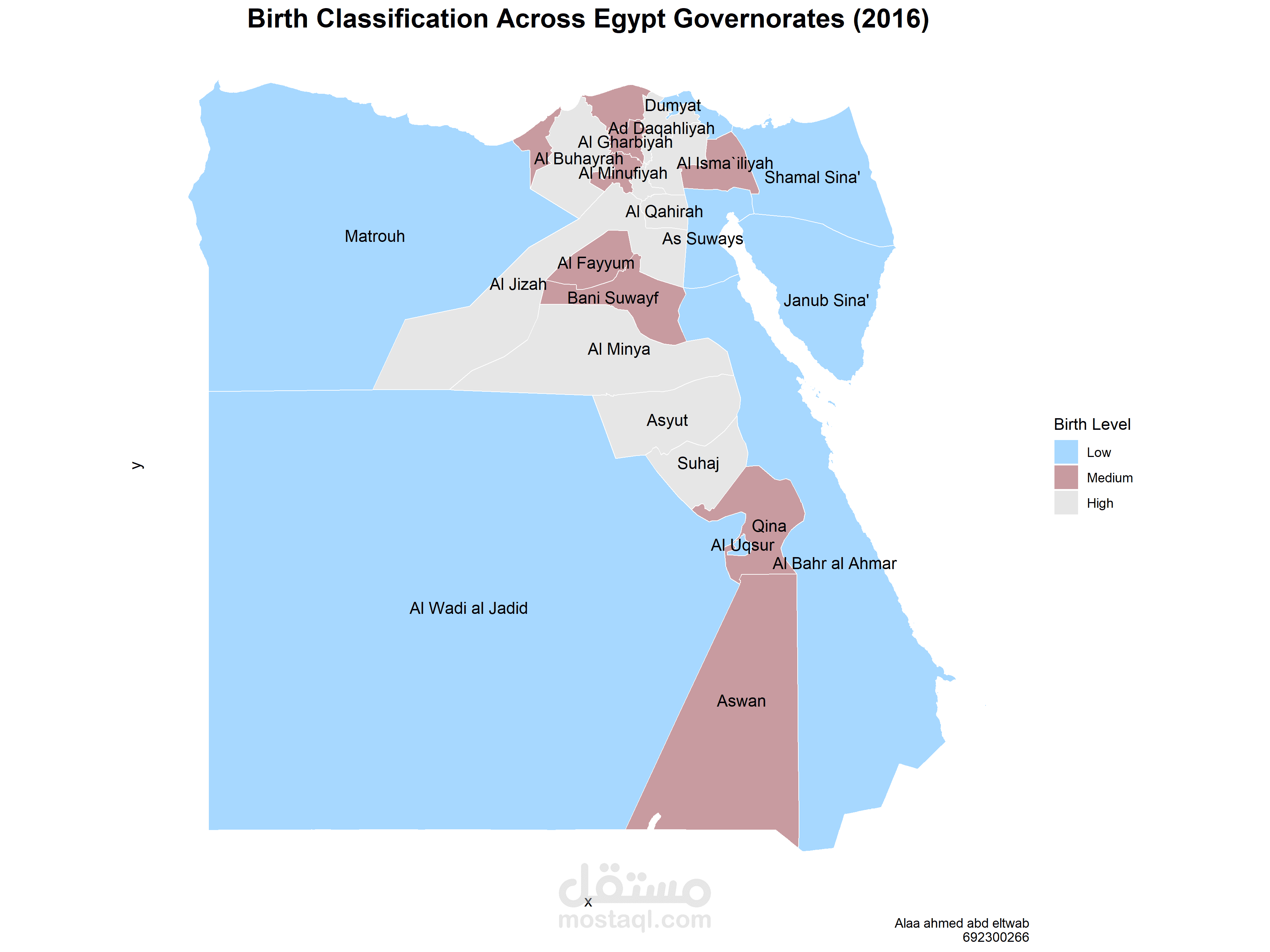
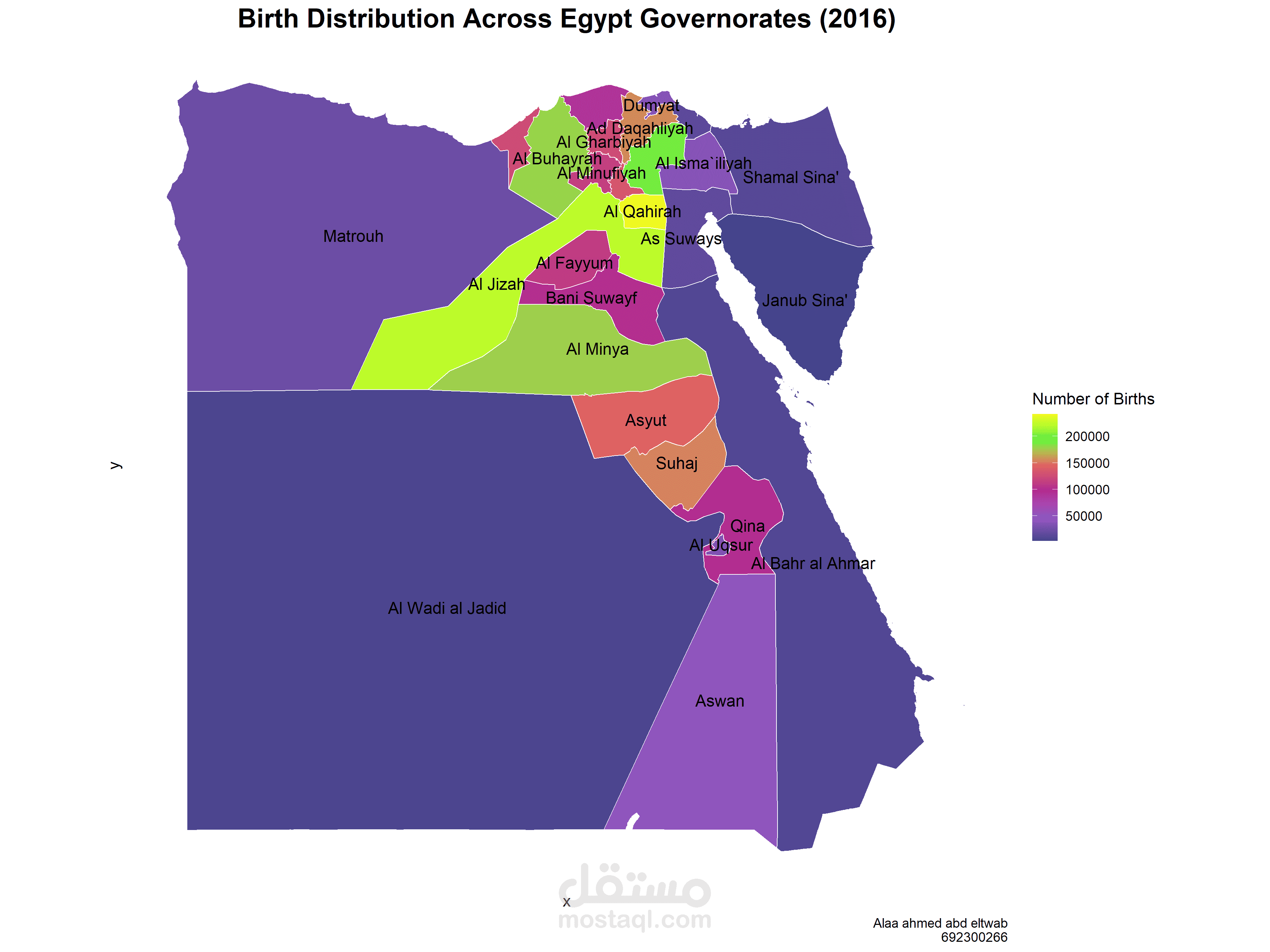
This project focuses on exploring and visualizing birth data in Egypt using data analysis and geographic visualization techniques.
Project Objectives
* Organize and examine birth-related datasets.
* Explore geographic data and its spatial attributes.
* Present the data through clear visualizations and maps.
* Support a better understanding of geographic data patterns.
Tools and Technologies
R, CSV datasets, and Shapefile geographic data.
Deliverables
The project includes data files and geographic visualization outputs that demonstrate the process of working with structured and spatial data.
This is a portfolio project demonstrating practical interest in data analysis and geospatial data visualization.