Land Survey, CAD Drafting & Location Plan
تفاصيل العمل
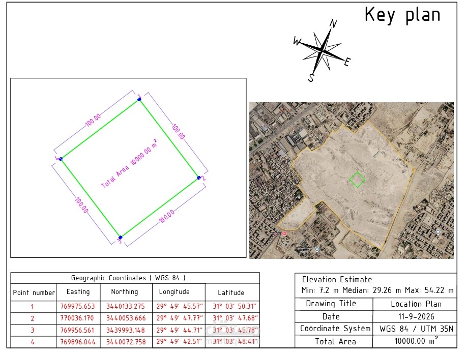
Prepared a professional land location plan in AutoCAD, including Google Earth imagery, land boundary, UTM WGS84 coordinates, Latitude/Longitude, area calculation, boundary dimensions, North Arrow, Key Plan, and professional CAD layout.