GAN Satellite to Map
تفاصيل العمل
Dataset Preparation:
Download paired satellite-to-map images from the Maps dataset.
Preprocess and split the data into training and validation sets.
Model Training:
Train the Pix2Pix GAN over 30 epochs.
Monitor generator and discriminator loss for balanced training.
Testing and Evaluation:
Test the model on unseen images.
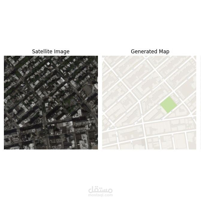
Visualize results by comparing satellite images, ground truth maps, and generated maps.
Results
The model successfully generates high-quality map images from satellite inputs, demonstrating its ability to handle real-world paired translation tasks.
Applications
Geographic visualization and planning.
Automated cartography.
Educational demonstrations of GAN applications.