Using ENVI 5.3 And Google Earth Enging to Remote Sensing Indicators calculation
تفاصيل العمل

ENVI 5.3 and Google Earth Engine are powerful tools for remote sensing and geospatial analysis. You can calculate various indicators using these platforms, facilitating a wide range of applications.
Data Acquisition: Google Earth Engine provides access to a vast repository of remote sensing data, including satellite imagery. You can import and manipulate this data for analysis.
Preprocessing: ENVI 5.3 is particularly useful for preprocessing remote sensing data. You can perform tasks like radiometric calibration, atmospheric correction, and image enhancement to prepare the data for analysis.
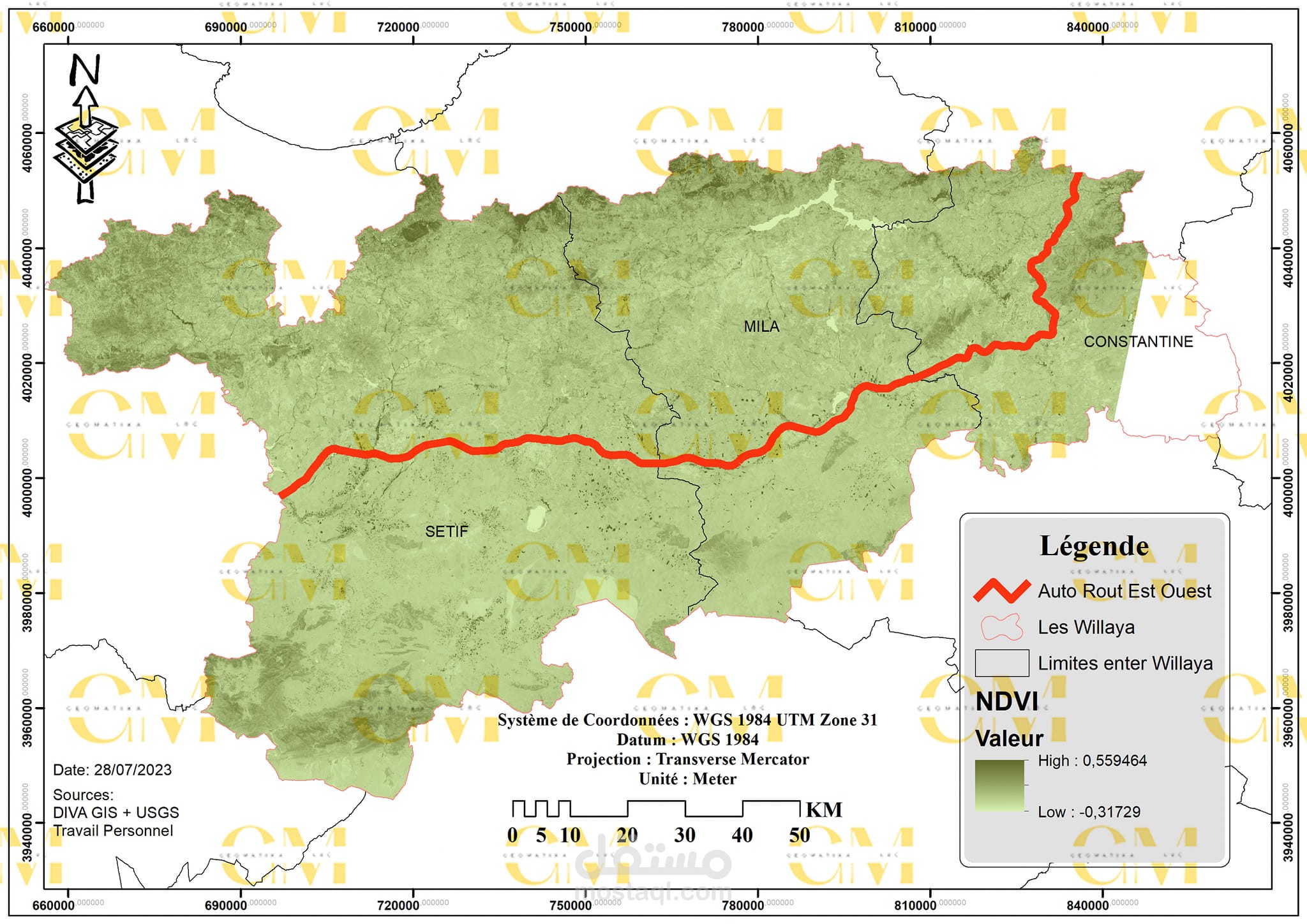
Vegetation Indices: Calculate vegetation indices like NDVI (Normalized Difference Vegetation Index) using Google Earth Engine. These indices help assess vegetation health and monitor changes over time.
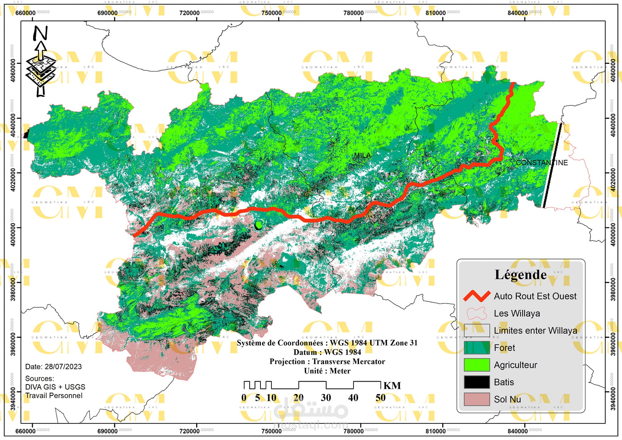
Land Cover Classification: Utilize ENVI for supervised or unsupervised classification to categorize land cover types from satellite imagery. Google Earth Engine can also be used for classification tasks.
Change Detection: Detect changes in land cover or vegetation using time-series analysis in Google Earth Engine. Identify deforestation, urban expansion, or other land cover changes.
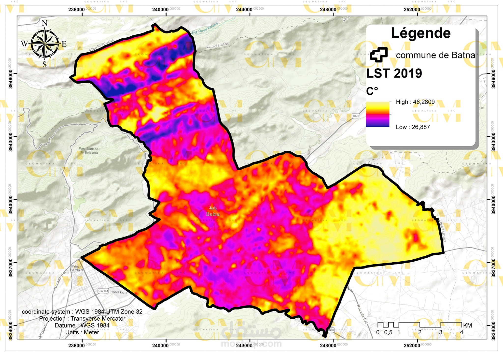
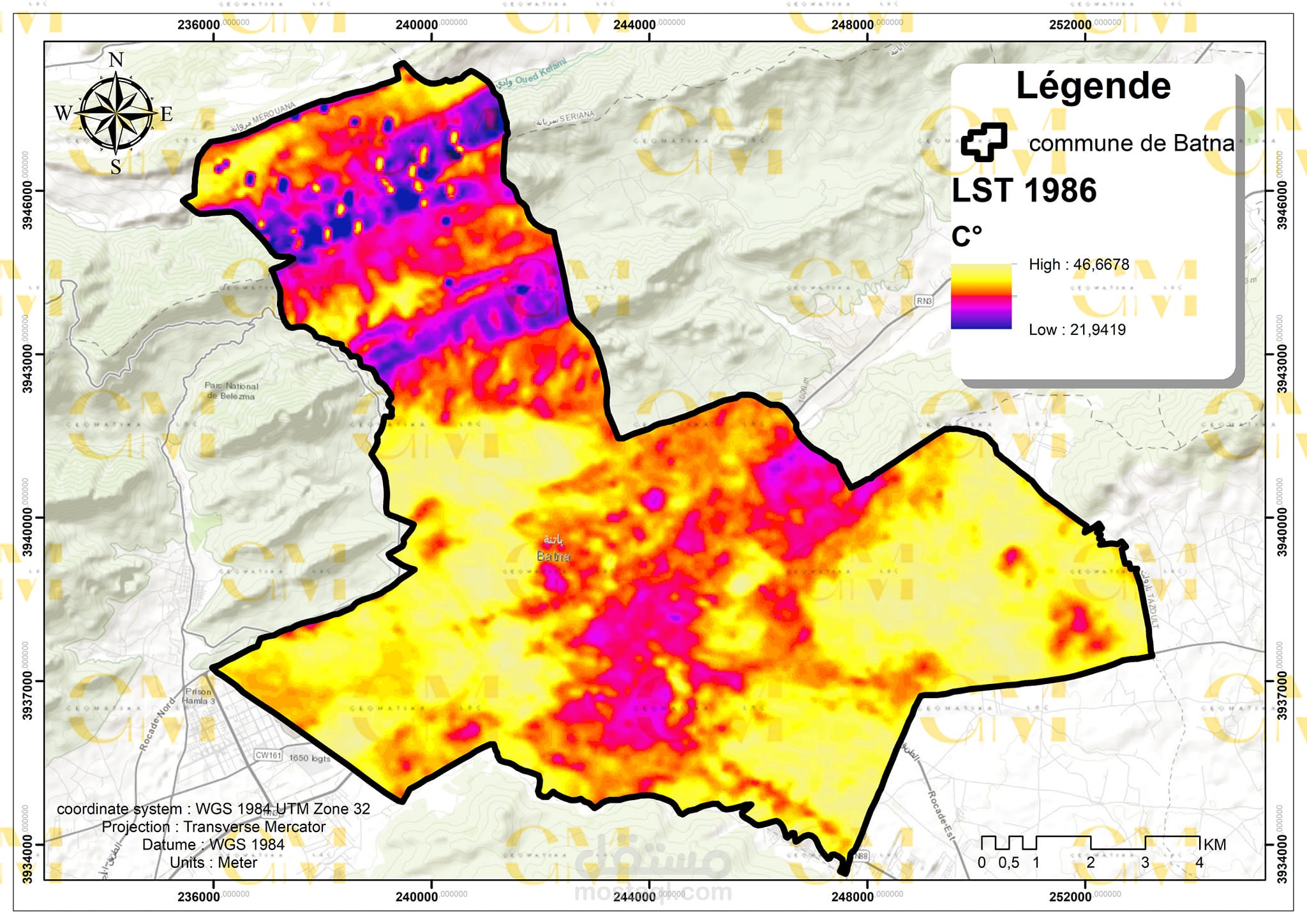
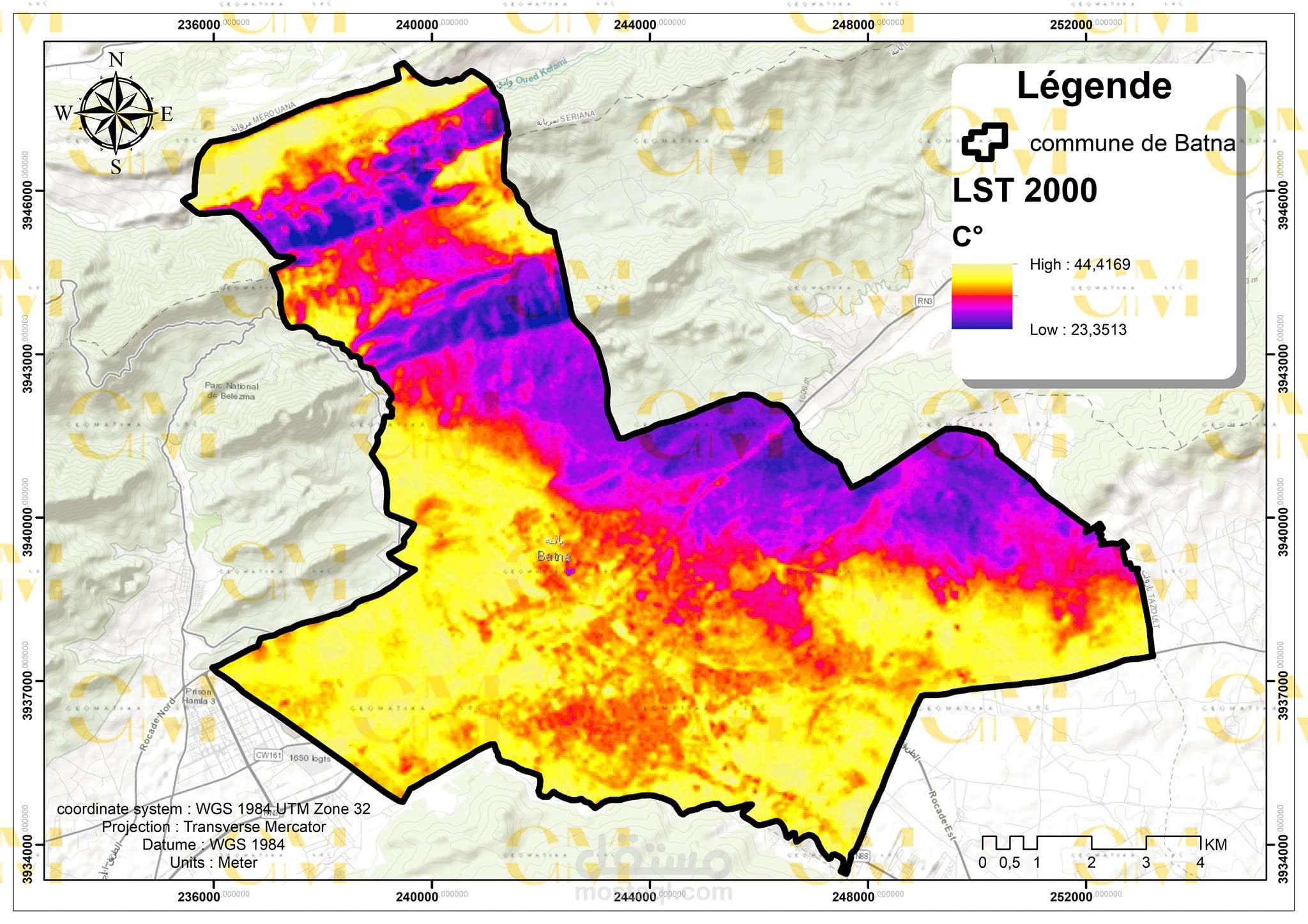
Environmental Monitoring: Calculate indicators related to environmental parameters like temperature, precipitation, and soil moisture using Google Earth Engine. Monitor trends and anomalies for research or decision-making.
Land Use Planning: Evaluate land suitability for various purposes, such as agriculture or urban development, by combining data from ENVI and Google Earth Engine.
Time Series Analysis: Google Earth Engine offers tools for time-series modeling, enabling the assessment of long-term trends and patterns in remote sensing data.
In summary, ENVI 5.3 and Google Earth Engine complement each other in remote sensing and geospatial analysis tasks. From vegetation monitoring to land cover classification and environmental assessment, these tools empower experts to calculate indicators that support a wide array of applications in Earth observation and geo-informatics.
بطاقة العمل
| اسم المستقل | حليم ر. |
| عدد الإعجابات | 0 |
| عدد المشاهدات | 129 |
| تاريخ الإضافة | |
| تاريخ الإنجاز |