Telecom Network Coverage Simulator & Visualizer (Python)
تفاصيل العمل
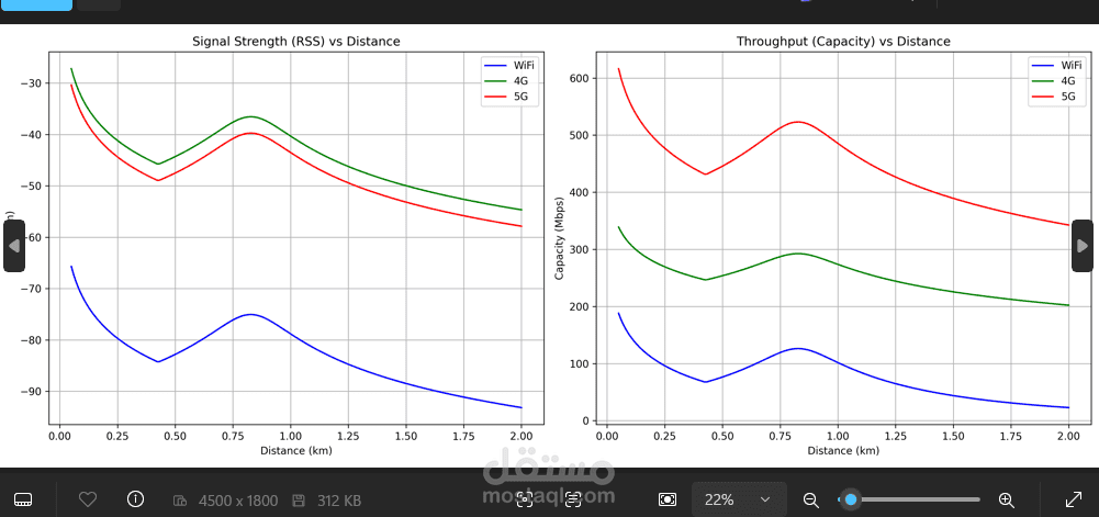
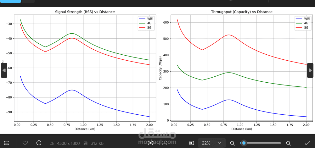
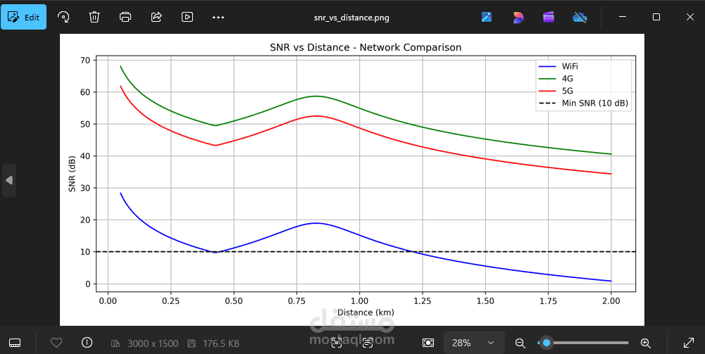
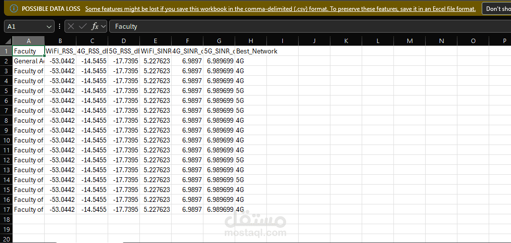
Project Overview: This project is an advanced, Python-based simulation and analysis tool designed for Mobile Networks and Telecommunications. It simulates and compares the performance of WiFi, 4G, and 5G networks in an urban environment (Tanta University campus) to determine the best network coverage and capacity for different locations.
Key Features & Engineering Metrics:
Signal Analysis: Computes Free Space Path Loss (FSPL), Received Signal Strength (RSS), SNR, and SINR based on distance and environmental interference.
Capacity Calculation: Uses Shannon's Capacity theorem to calculate network throughput (Mbps) for each network type.
Coverage Check: Automatically determines the optimal network (WiFi, 4G, or 5G) for specific geospatial coordinates (Faculties) based on signal quality.
Data Visualization: Generates high-quality graphs comparing networks (RSS vs Distance, SNR/SINR impact, Coverage percentage).
Interactive Mapping: Automatically generates an interactive HTML map pinpointing locations, displaying tooltips with calculated metrics and the recommended network.
Technologies & Libraries Used:
Language: Python 3
Data Processing: Pandas, NumPy
Mathematical Modeling: Custom telecom physics models (Haversine formula for geospatial distance, dbm/mw conversions).
Visualization: Matplotlib (for analytical plotting), Folium (for interactive web maps).
Implementation Details: The script was developed to provide an automated, data-driven approach to network planning. It executes a dynamic sweep across varying distances, calculates complex RF (Radio Frequency) parameters considering real-world interference, exports analytical CSV reports, and generates both graphical and geographical visual outputs to aid in decision-making.