🚧 Wastewater Network GIS Project – Al Kharj
تفاصيل العمل
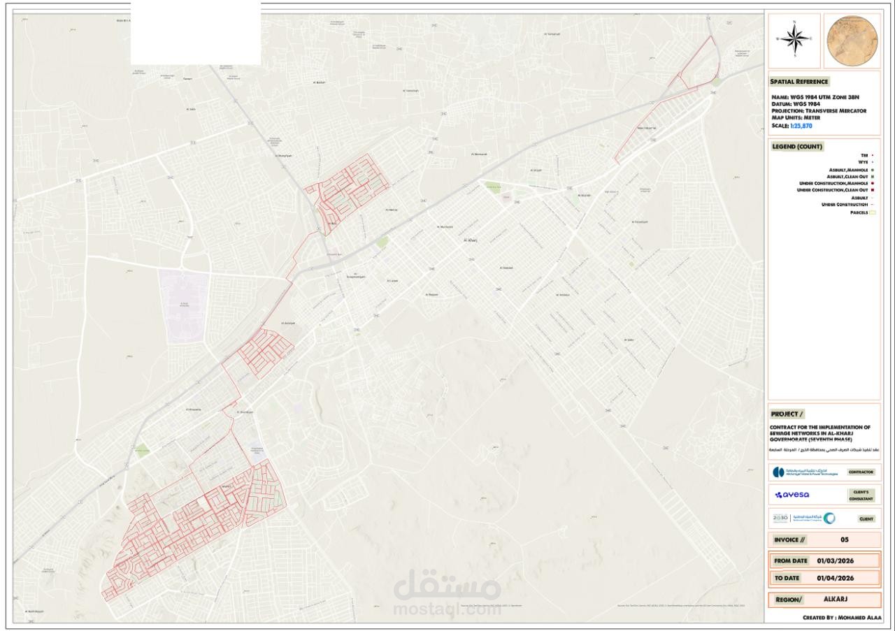
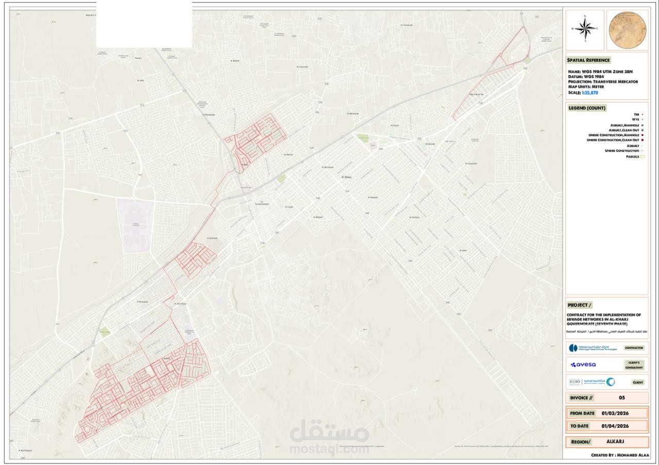
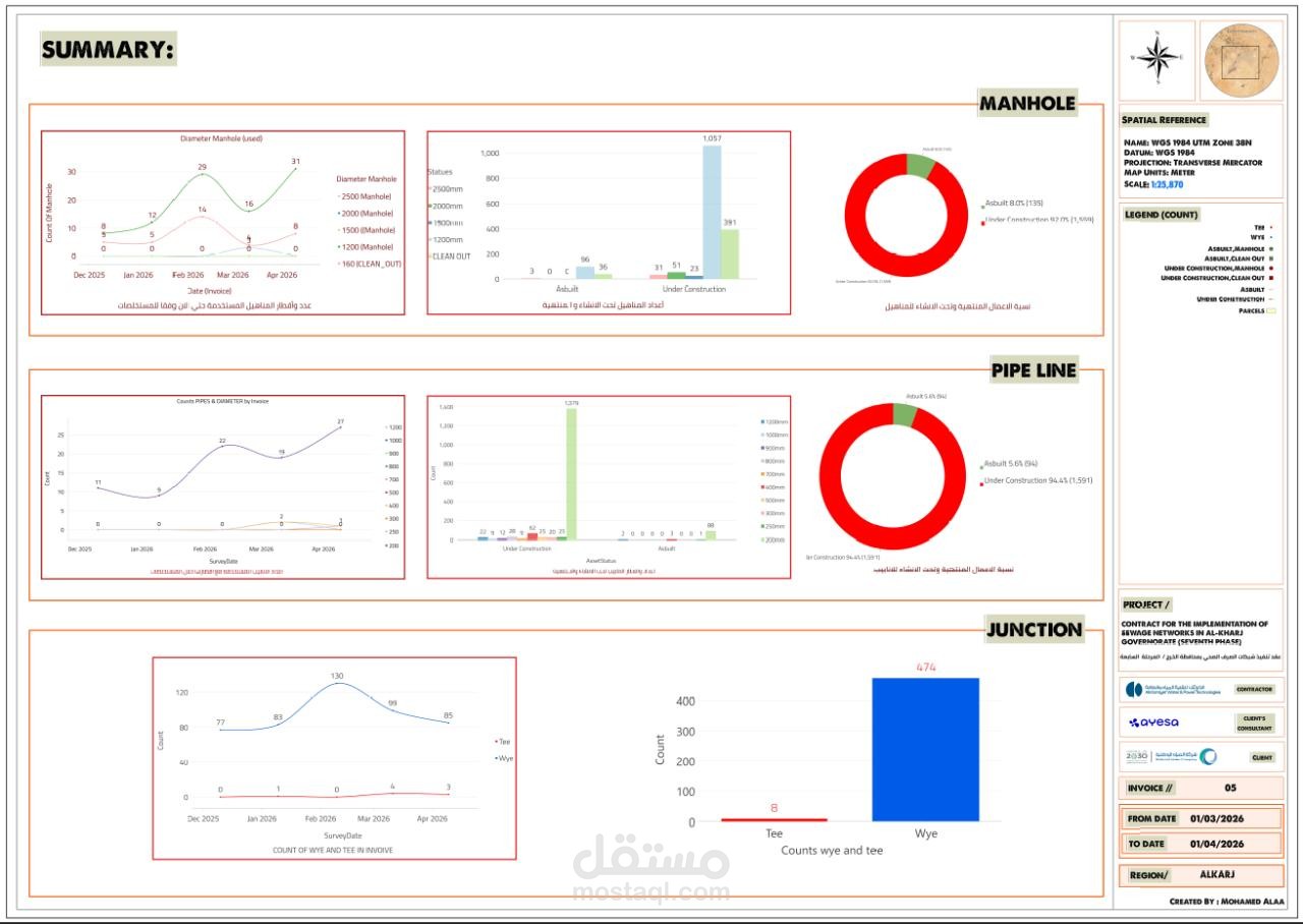
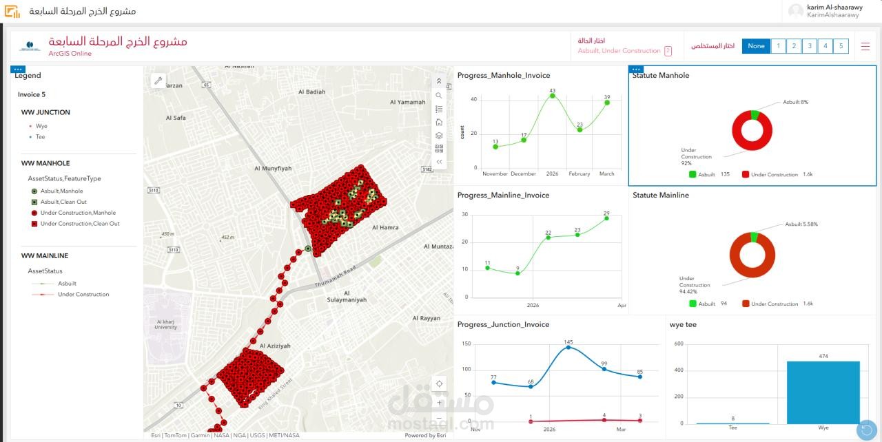
worked on analyzing and mapping a wastewater network using GIS, focusing on building an accurate as-built dataset for infrastructure management.
🔹 Key Work:
* Mapping sewer pipelines, manholes, and cleanouts
* Differentiating between as-built and under-construction assets
* Applying spatial reference system (WGS 1984 UTM Zone 38N)
* Preparing a clear and readable layout for field and office use
🔹 Value:
This type of work helps contractors and engineers ensure network connectivity, detect errors, and support future maintenance and expansion.
🔹 Next Step:
Enhancing the dataset using topology rules and utility network for advanced analysis (flow tracing & network validation).