Produced land cover maps using remote sensing and GIS
تفاصيل العمل
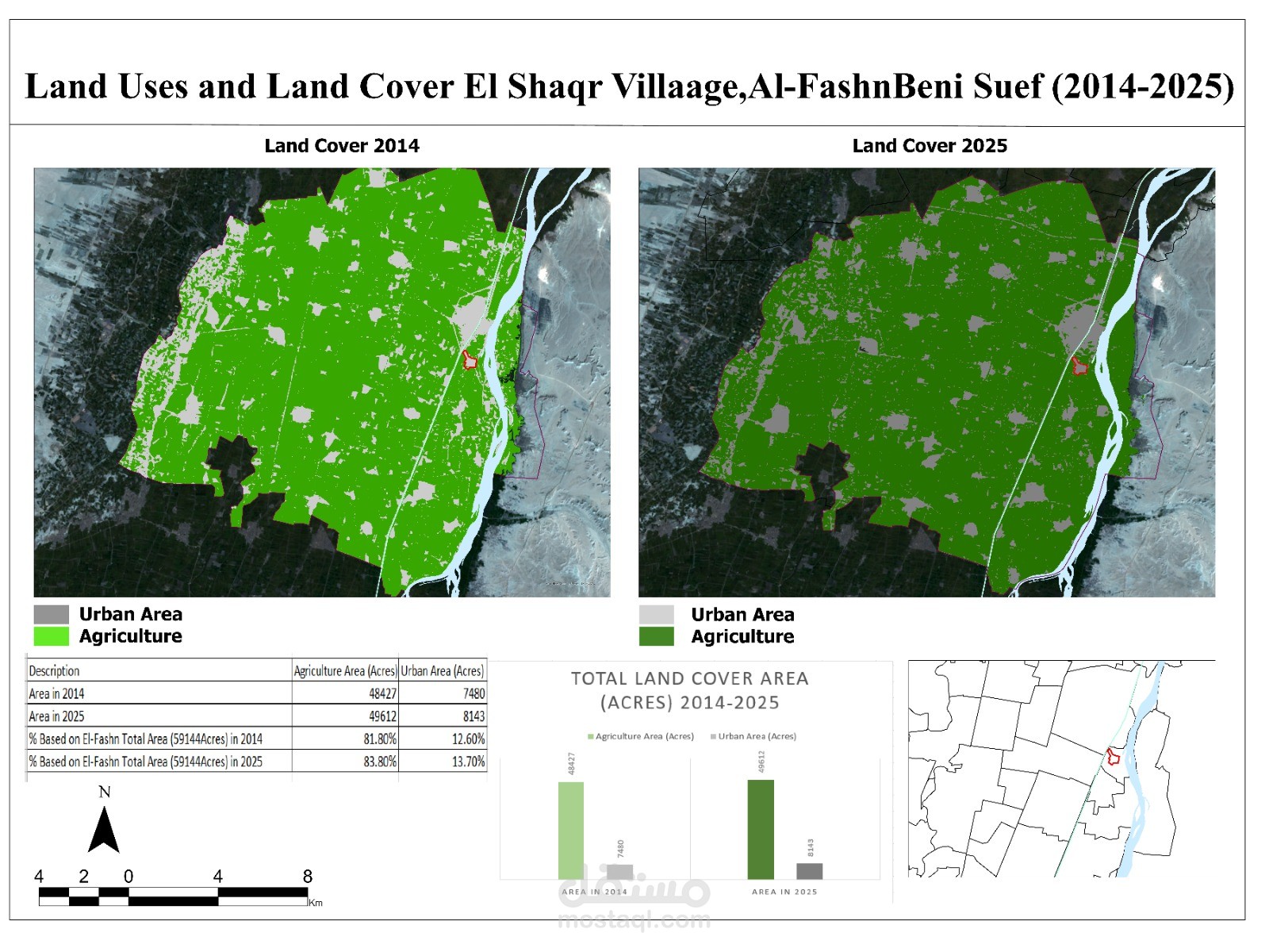
Preparation of land cover maps and analysis of urban sprawl and agricultural encroachments using Remote Sensing and GIS techniques.
Preparation of land cover maps and analysis of urban sprawl and agricultural encroachments using Remote Sensing and GIS techniques.