Environmental Study Using GIS (Geographic Information Systems)
تفاصيل العمل
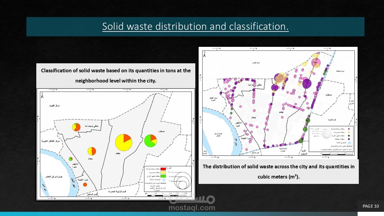
تحليل مكاني متكامل لتوزيع وتصنيف النفايات الصلبة على مستوى الأحياء والمدين
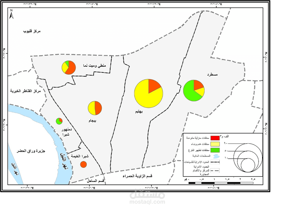
يوضح تصنيف النفايات عبر دوائر بيانية متدرجة الحجم تعكس الكميات النسبية لكل حي
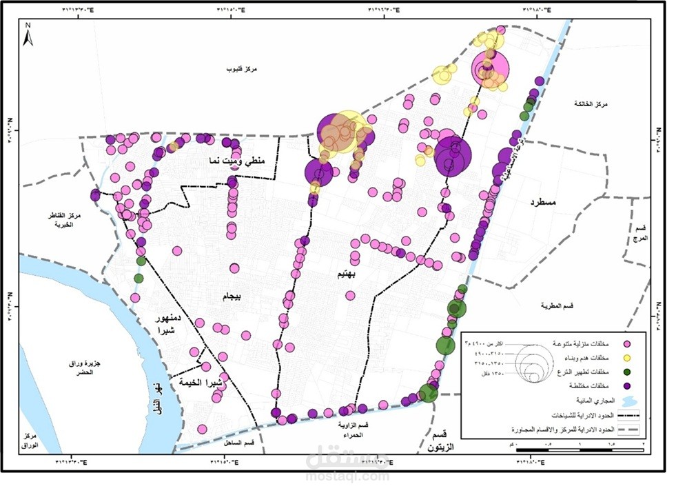
خريطة تُظهر التوزيع المكاني للنفايات عبر نقاط ملونة متفاوتة الحجم تشير إلى كثافة التراكم في كل موقع. يُستخدم في دراسات إدارة المخلفات، التخطيط البيئي، تحديد مواقع المحارق والمدافن، وإعداد تقارير الاستدامة الحضرية للجهات الحكومية والاستشارية.
An integrated spatial analysis of the distribution and classification of solid waste at the district and city levels.
It illustrates waste classification through graduated pie charts that reflect the relative quantities for each district.
A map showing the spatial distribution of waste using colored points of varying sizes, indicating the accumulation density at each location.
This is used in waste management studies, environmental planning, identifying locations for incinerators and landfills, and preparing urban sustainability reports for governmental and consulting entities.