Detecting burned areas from satellite imagery
تفاصيل العمل
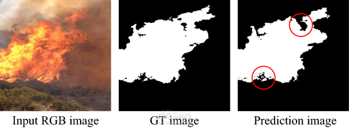
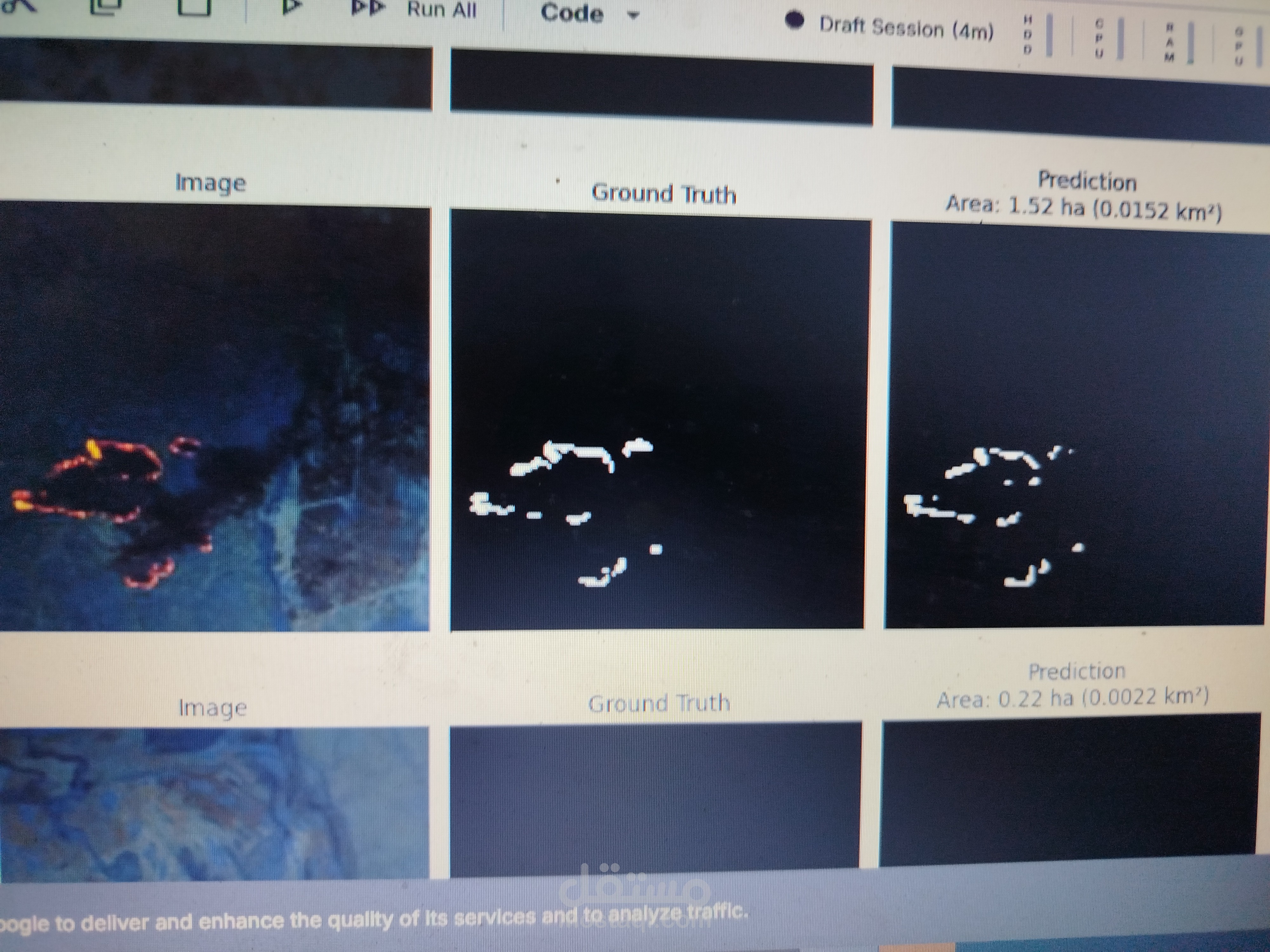
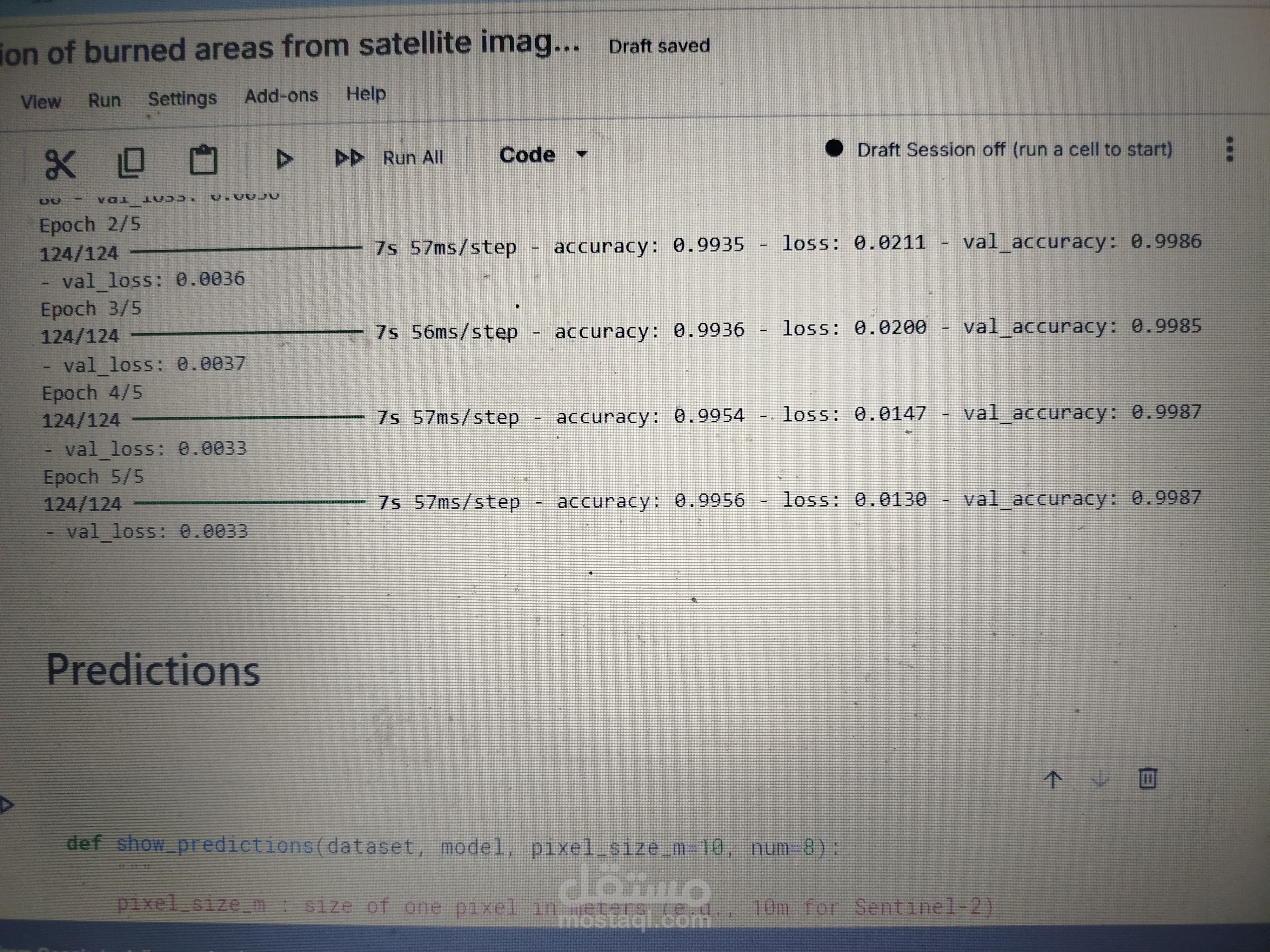
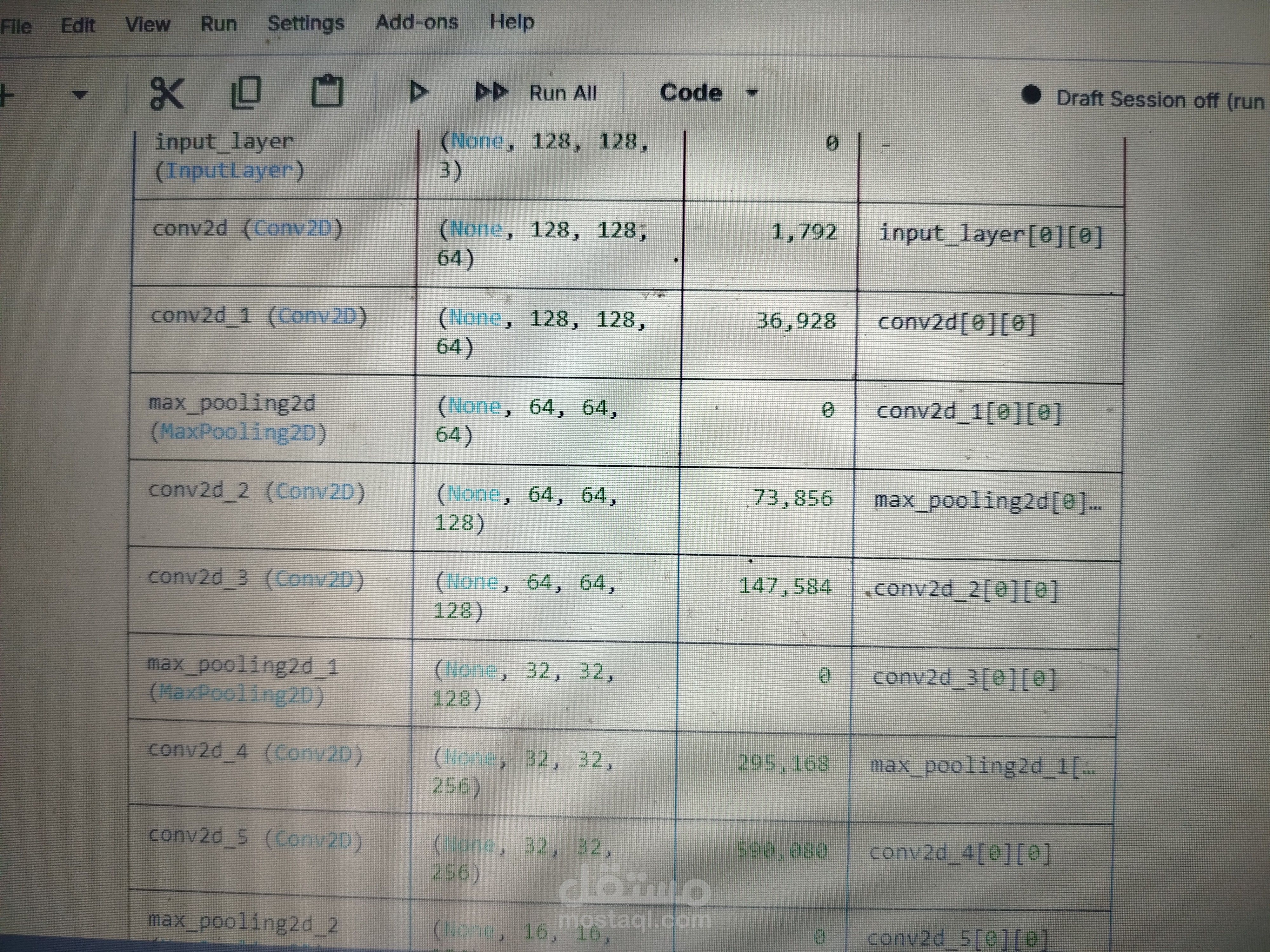
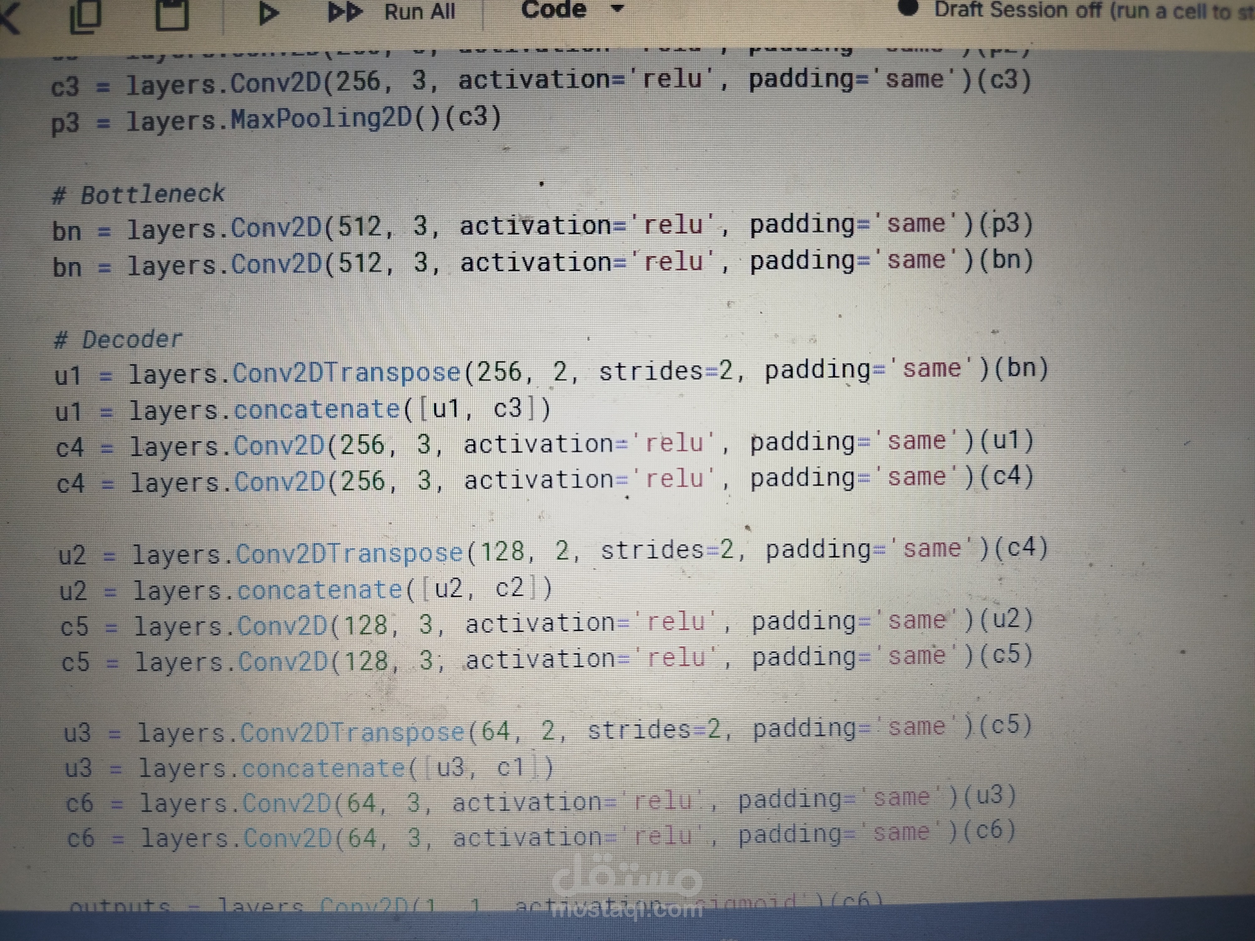
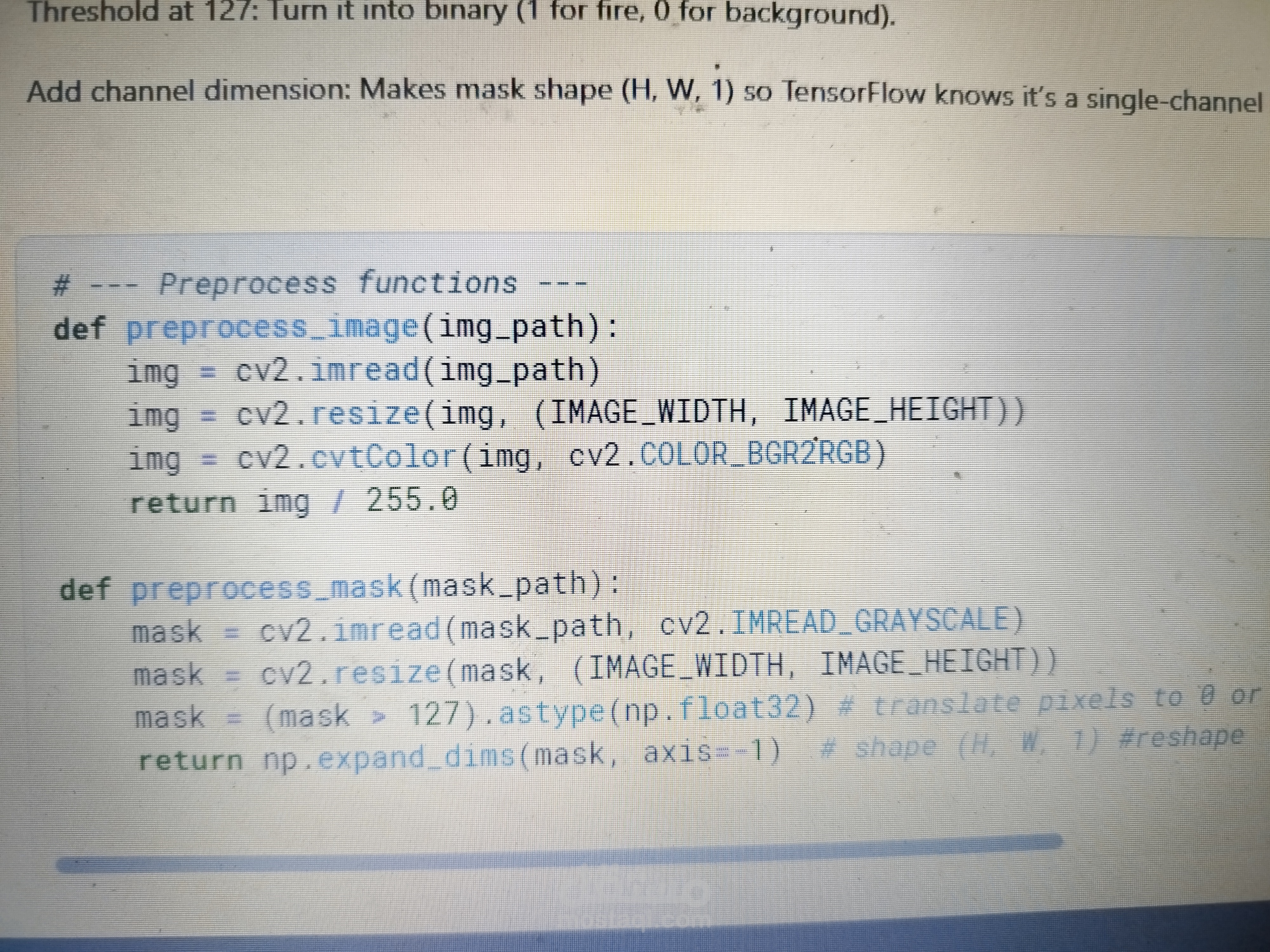
This project leverages a U-Net deep learning architecture implemented in TensorFlow to perform high-precision semantic segmentation of burned areas from multi-spectral satellite imagery. By utilizing an encoder-decoder framework, the model captures complex spatial features and spectral signatures to accurately delineate fire scars, distinguishing them from similar land covers like shadows or dark soil. My solution includes a complete end-to-end pipeline—from preprocessing raw satellite bands and handling class imbalance with specialized loss functions (such as Dice or Focal loss) to generating actionable, high-resolution geo-masks. This automated approach provides a rapid, scalable, and highly accurate alternative to manual mapping, offering essential data for environmental impact assessment and forest recovery management.