AeroScan – Aerial Image Segmentation & Analysis (Digital Image Processing Project)
تفاصيل العمل
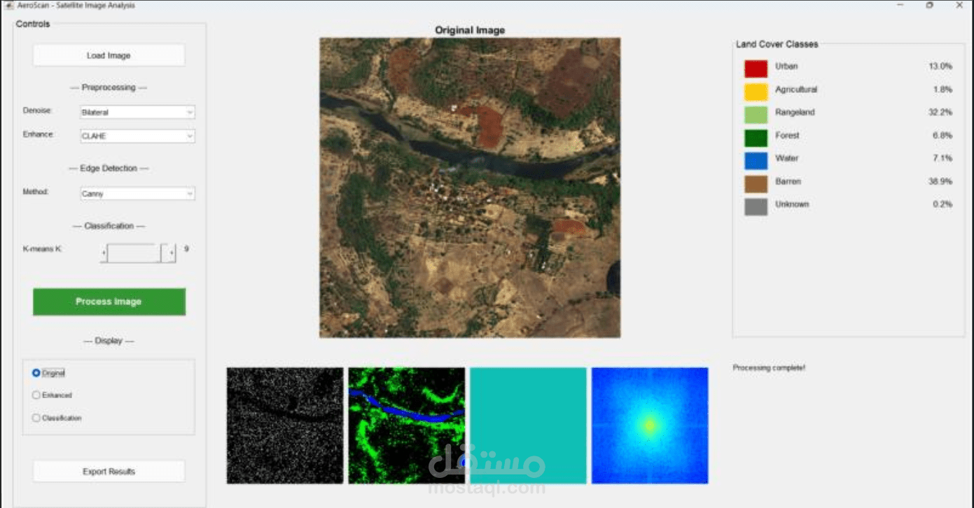
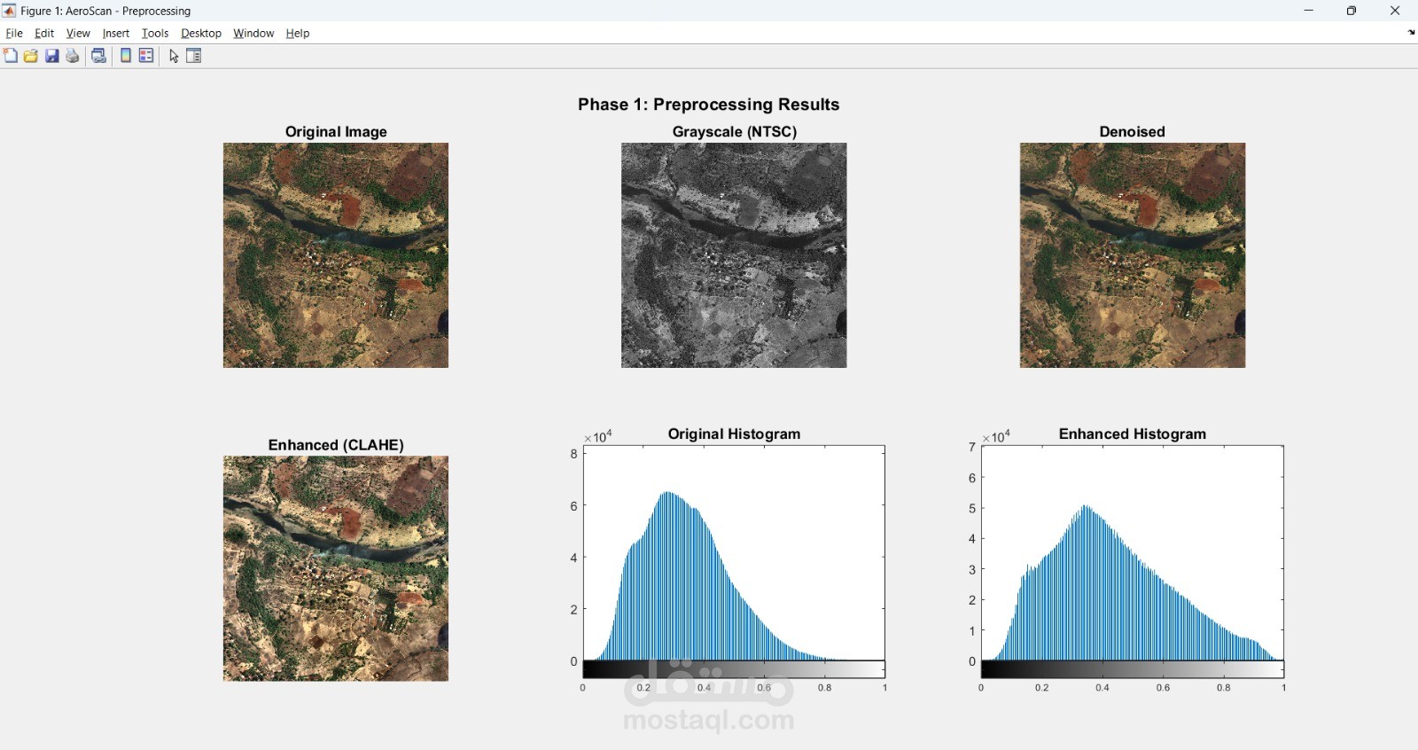
AeroScan is a digital image processing project focused on analyzing aerial and satellite images for land-cover segmentation and classification.
The system performs image preprocessing, feature extraction, and segmentation using both spatial domain and frequency domain (FFT) techniques. Frequency analysis was used to improve texture discrimination, edge detection, and noise robustness. Image segmentation was implemented using K-means clustering and region-based methods, followed by classification of different land types such as vegetation, urban areas, and water bodies.
A graphical user interface (GUI) was developed to visualize the processing stages and final segmentation results.
Technologies: MATLAB, Digital Image Processing, FFT, Image Segmentation, K-means, GUI