Relief Center
تفاصيل العمل
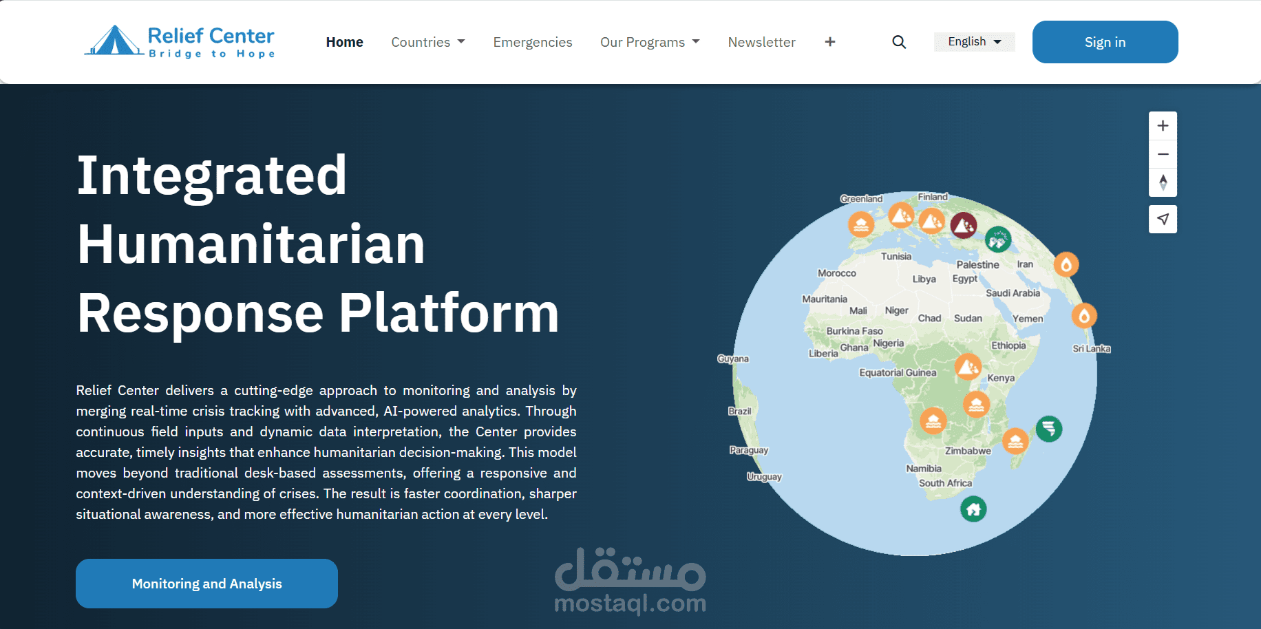
Architected and developed a comprehensive disaster management platform on Odoo 19 that provides real-time disaster tracking, 3D visualization, automated alert systems, and
relief coordination with full CRM integration.
Technical Highlights:
- Multi-Source Data Integration: Automated fetching from USGS (earthquakes), NASA EONET (wildfires), and GDACS (floods, cyclones, volcanoes) with intelligent deduplication
- Advanced Geocoding Pipeline: Achieved 97%+ success rate with 3-tier fallback system (Google Maps API → Geoapify Batch API → Nominatim + spaCy NLP)
- 3D Interactive Globe: MapTiler SDK-powered visualization with real-time disaster plotting, country-based filtering, and mobile-responsive design supporting 163 countries
- Security-First Architecture: CSRF protection, session-based rate limiting (10-120 req/min), origin validation, and API key authentication with SHA256 hashing
- Performance Optimization: 60-75% improvement with LRU caching, coordinate clustering reducing API calls by 40-60%, auto-commit strategies every 500 records
Modules Developed (7):
1. Core disaster tracking with dynamic icon generation
2. 3D globe visualization with OWL component architecture
3. Subscription & notification system with automated email alerts
4. Email OTP authentication (6-digit codes, 3-min expiry, countdown timer)
5. Custom website theme with knowledge hub and forum integration
6. Public website with country profiles and real-time statistics
7. Webhook API for external disaster data ingestion with API key auth
Tech Stack: Odoo 19, Python 3.12, PostgreSQL 13+, OWL (Odoo Web Library), MapTiler SDK, Bootstrap 5, Chart.js, SCSS, Geopy, spaCy
Impact: Complete disaster lifecycle management from detection to relief coordination with portal self-service and automated CRM opportunity creation.