Road Network Classification & Analysis – Katameya
تفاصيل العمل

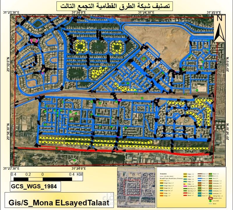
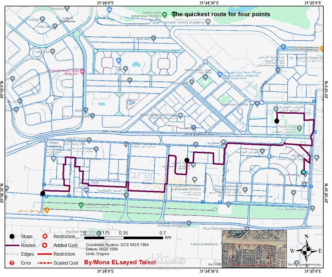
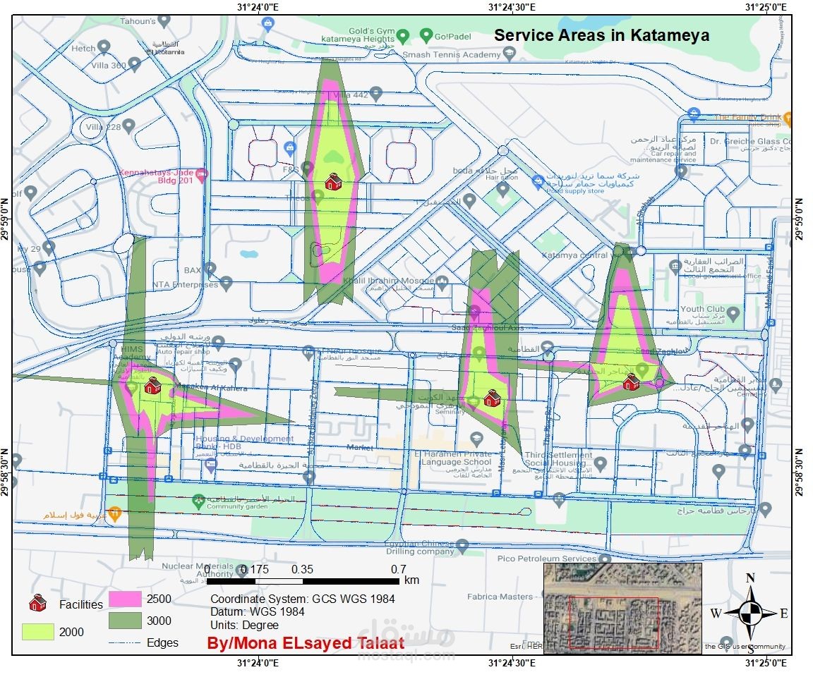
In this project, I focused on road network classification and advanced network analysis for Katameya area using ArcGIS Pro Creating a geodatabase for roads and applying topology rules Manual digitizing of road features without using ready-made data.
Classifying the road network into main, secondary, and local streets.
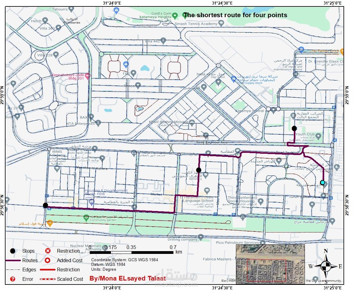
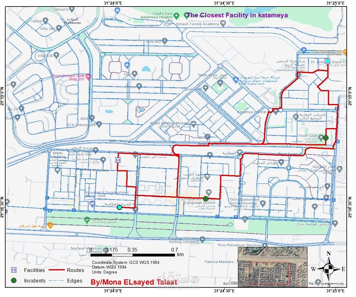
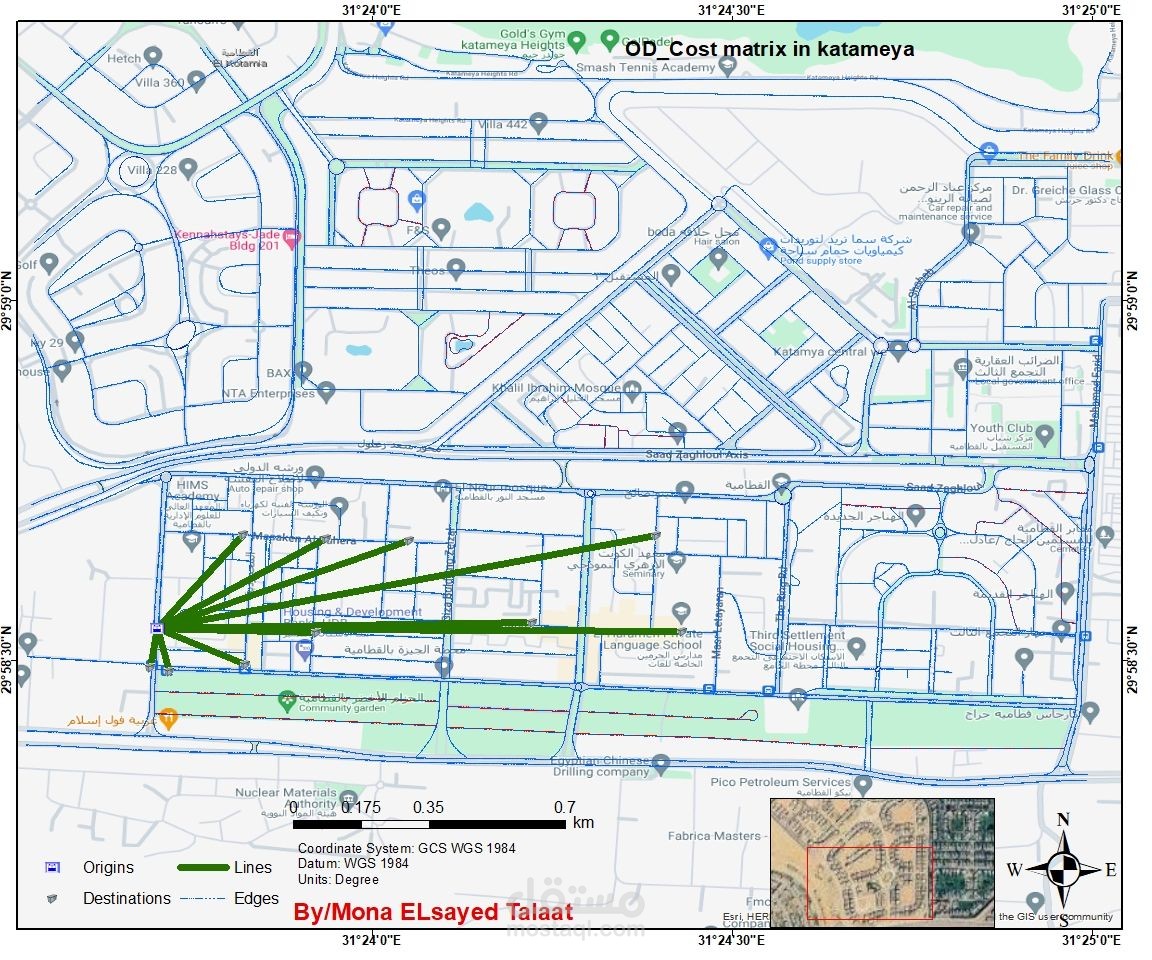
Performing different network analysis operations such as shortest path, service areas, and accessibility mapping.
Producing professional cartographic maps outputs to support urban planning and mobility studies