Full GIS Mapping, Road Analysis & 3D Animation for Future City – Egypt
تفاصيل العمل
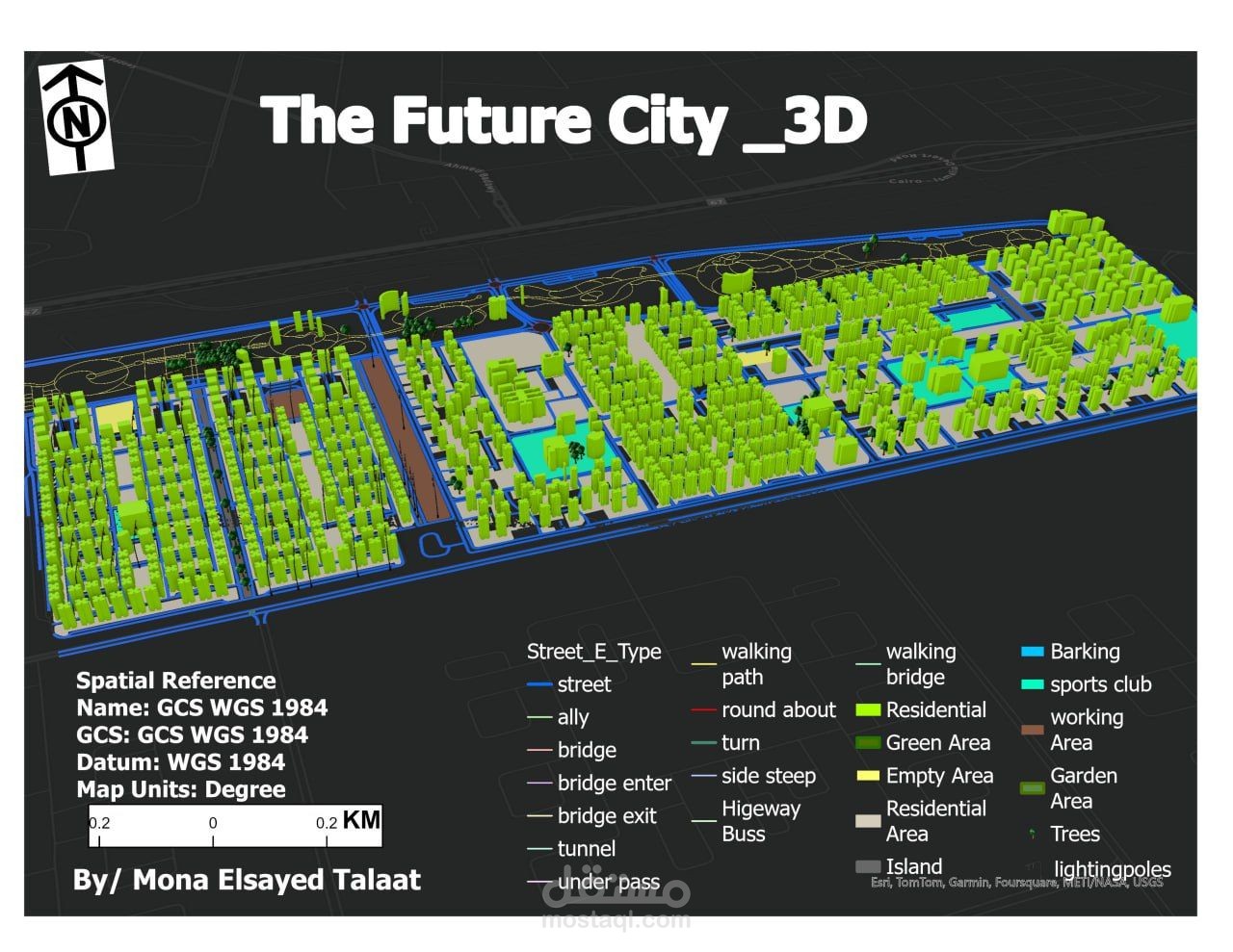
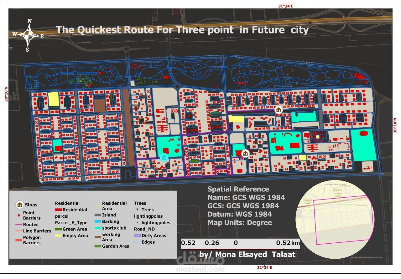
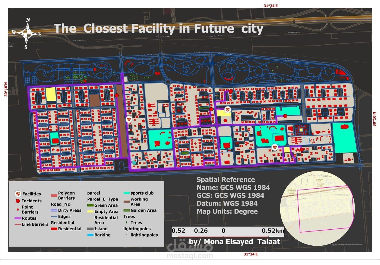
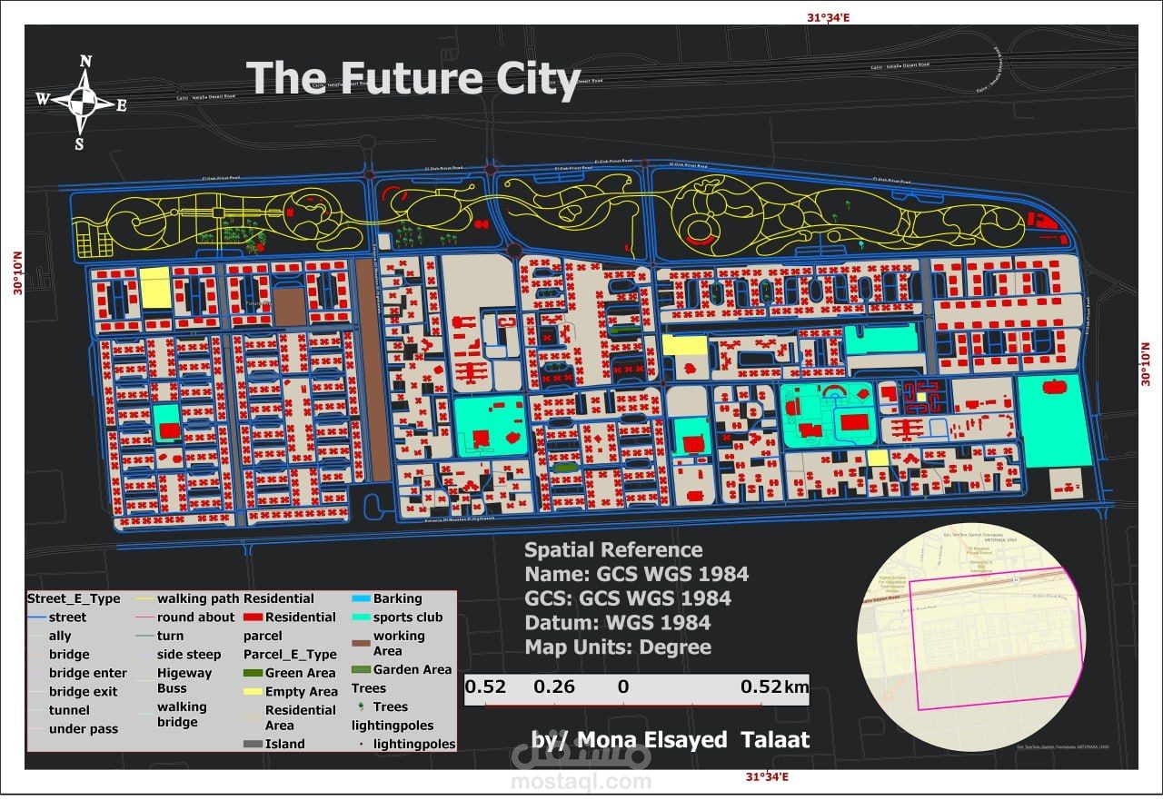
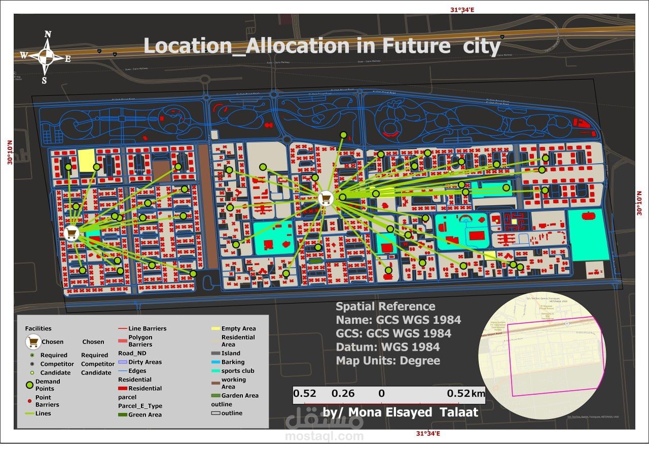
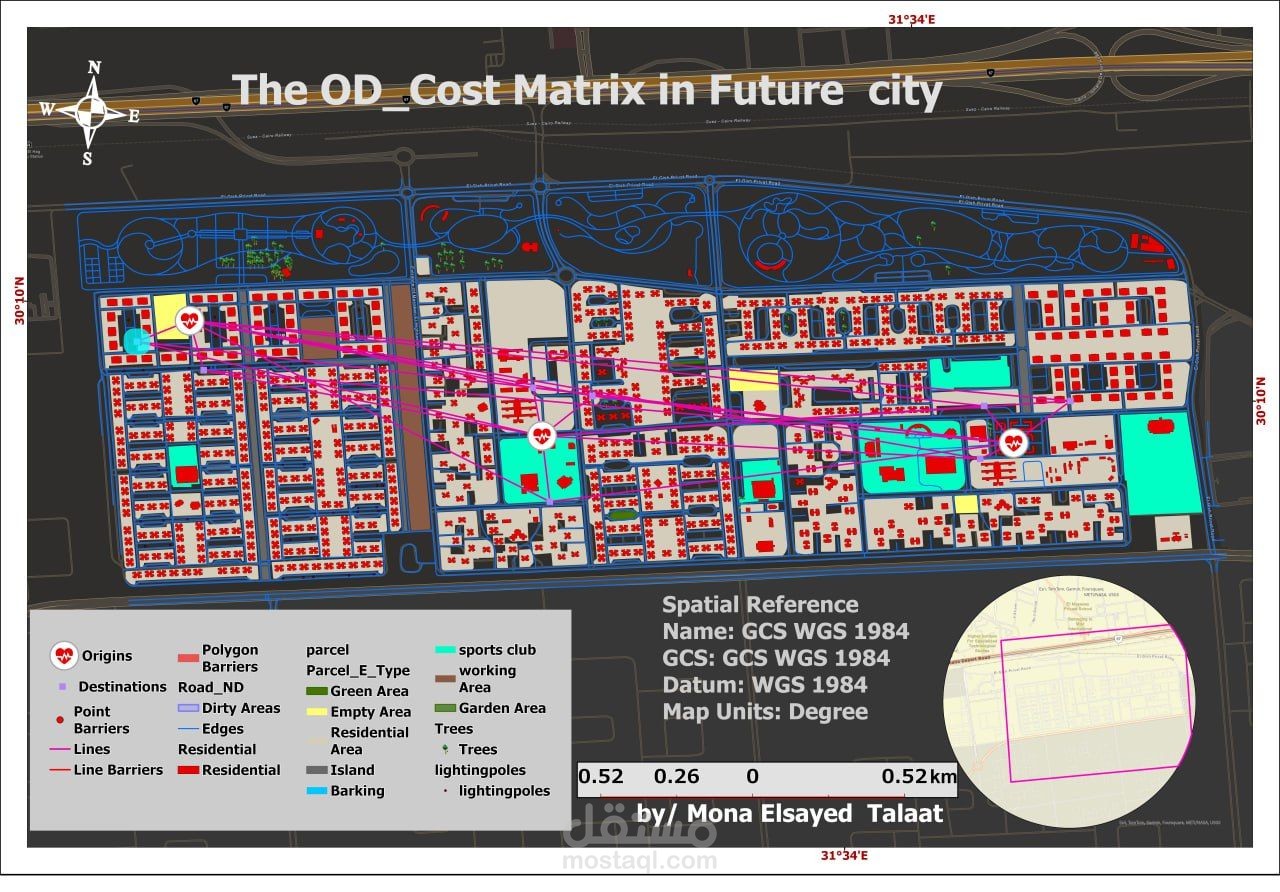
Developed a complete GIS project for Madinat Al Mostakbal – Egypt using ArcGIS Pro
Performed georeferencing and map projection for aerial imagery, created a detailed geodatabase for roads, buildings, land use, and boundaries with proper classification and topology correction.
Produced professional cartographic map layouts, 3D visualization, and an animation video, in addition to conducting road network analysis for accessibility and connectivity evaluation