Cross-Border Internet Speed Comparisons between Uruguay and Paraguay A Geospatial Analysis of Digital Connectivity and Nighttime Light Intensity
تفاصيل العمل
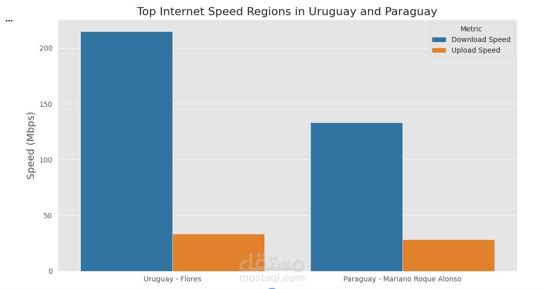
This study presents a comparative analysis of internet performance across the border regions of Uruguay and Paraguay, integrating network speed metrics with geospatial and nighttime light intensity data. Using data from Ookla Speedtest for Q3 2023 and VIIRS satellite-based light intensity imagery from July to September 2023, the project evaluates fixed internet download and upload speeds, latency, and associated infrastructure density at the regional level.
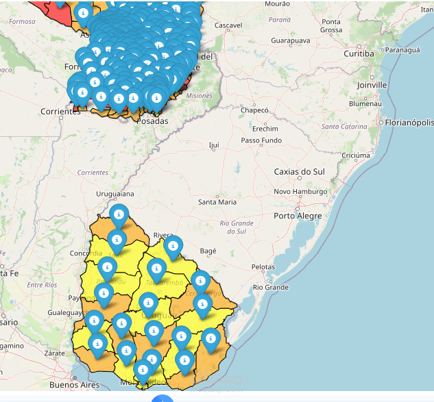
Geographic Information System (GIS) tools were used to preprocess spatial boundaries and align raster data with national subdivisions, enabling the creation of polygonal grids for precise spatial joins. After filtering and aggregating performance metrics, both countries’ datasets were merged to examine cross-border disparities and similarities. The results provide insights into digital connectivity in each country’s interior and highlight patterns of urbanization and network reach through the correlation with nighttime luminosity. This integrated geospatial approach offers valuable implications for policymakers and network providers aiming to improve internet equity in South America’s border zones.