Vegetation Dense monitoring
تفاصيل العمل
Monitoring large agricultural areas became a challenging task
for agronomists, especially in large agricultural investments
with different varieties. Remote sensing techniques
(specifically, Vegetation Indices) were created because they can
speed up the process and provide information that the human
eye cannot detect it.
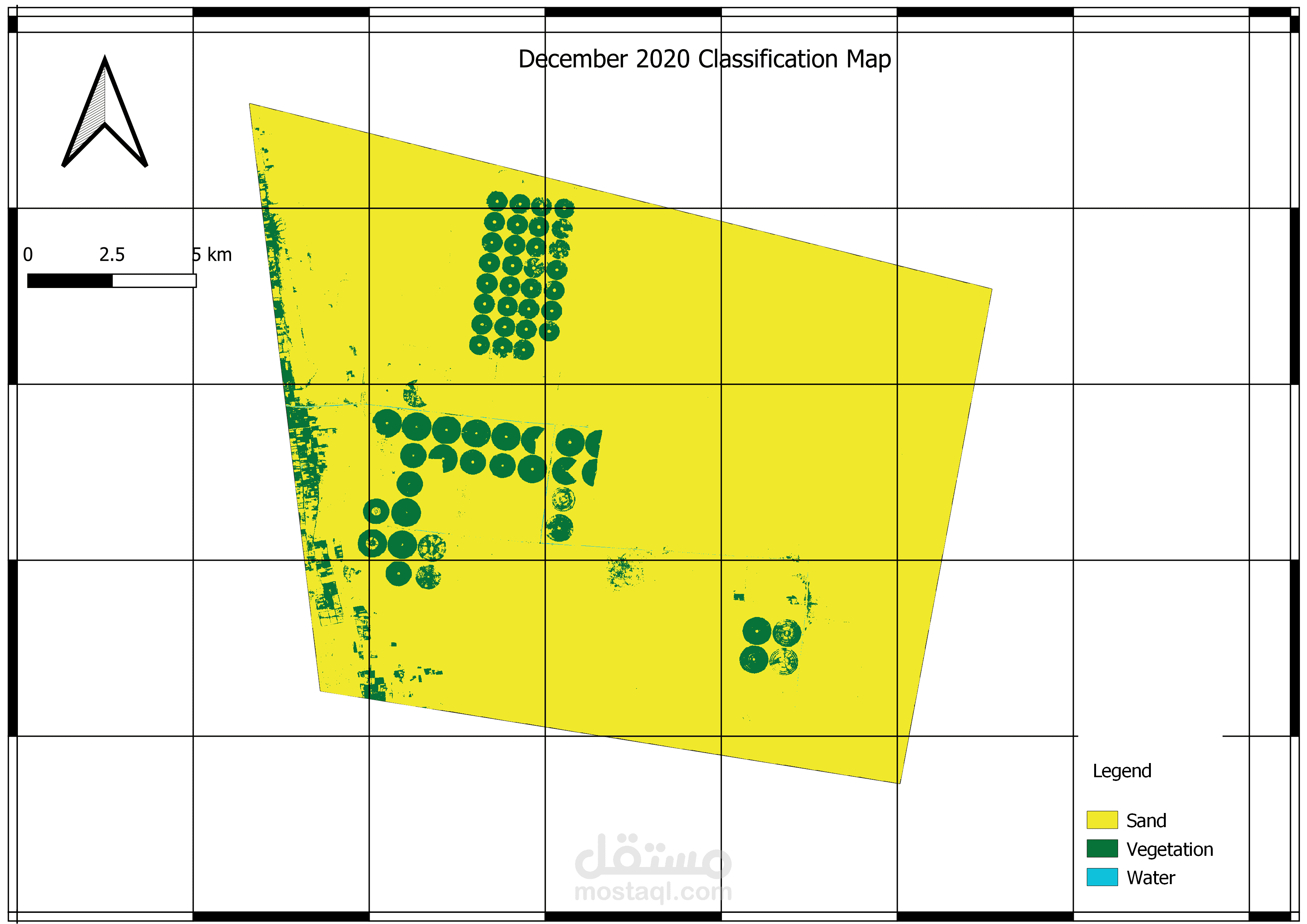
The Normalized Difference Vegetation Index (NDVI) was
calculated for two separate months September, December in the
seasons (2019 and 2020) for a project in Barber, River Nile state
in Sudan, using Sentinel-2 multispectral satellite imagery. These
index indicate the vegetation.
A temporal analysis was used to highlight changes in vegetation
between the beginning of the season (September) and the end of
the season (December).
Images for both months were analysed, and difference maps were
constructed to show where the vegetation varied.