Data Analyst & Deep Learning Engineer
تفاصيل العمل
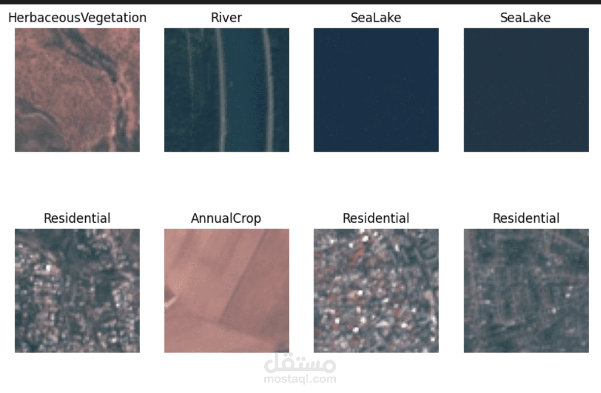
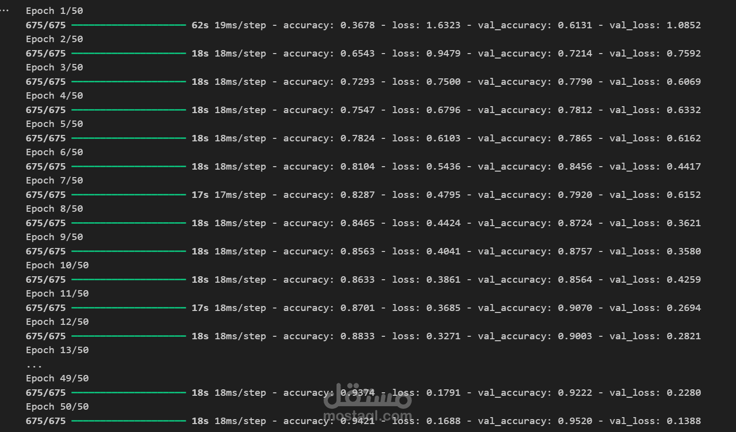

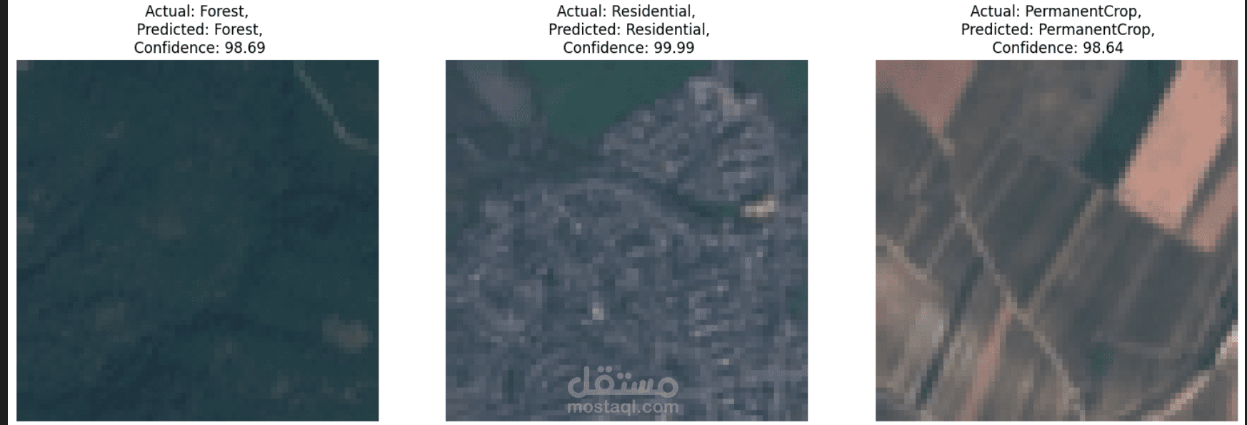
Developed a deep learning model to classify land types (urban, water, desert, agriculture, etc.) using multispectral Sentinel-2 satellite imagery. I led the end-to-end pipeline—from data collection and preprocessing to training and deploying a robust CNN. The model improves decision-making in urban planning and environmental monitoring by providing accurate, real-time land classification. Delivered scalable solutions with optimized model performance and cloud-ready deployment.