Land Use and Urban Expansion in Al-Jazirah Village – 2019
تفاصيل العمل
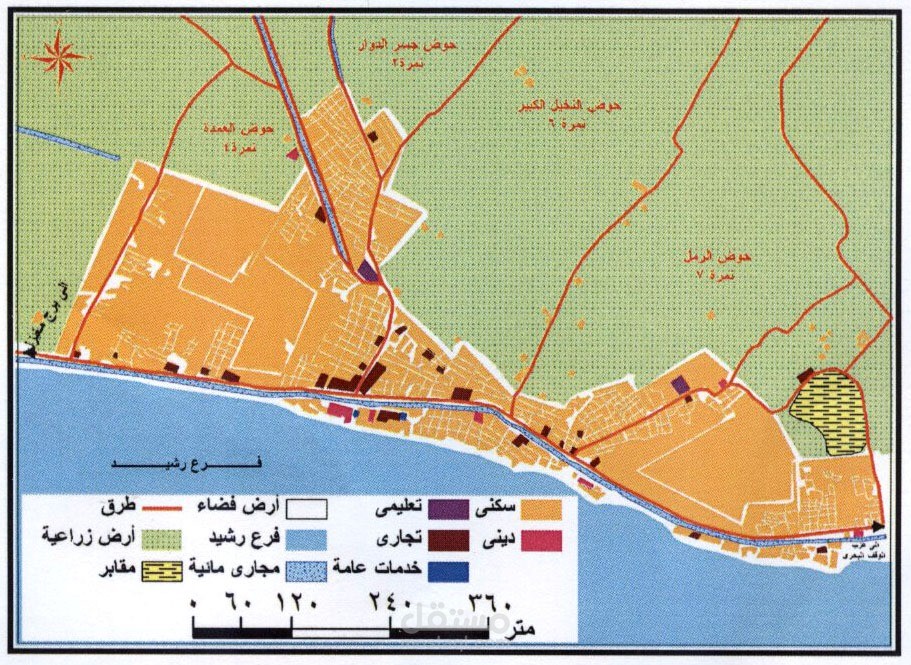
Description:
Developed a thematic map to analyze the urban mass, agricultural lands, and water streams in Al-Jazirah Village.
.The project supported decision-making related to urban planning and land management
Tools Used: ArcGIS