The use of Remote Sensing to investigate the Impacts of Urban Expansion in the City of Irbid, Jordan استخدام الاستشعار عن بعد لدراسة آثار التوسع الحضري في مدينة اربد، الأردن
تفاصيل العمل
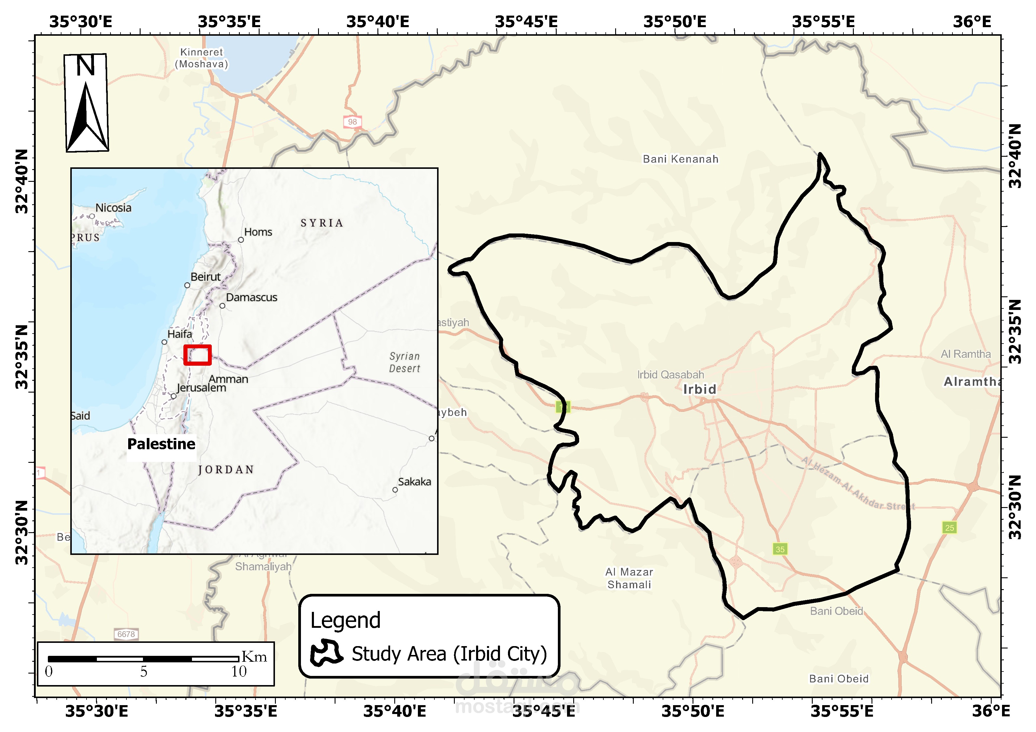
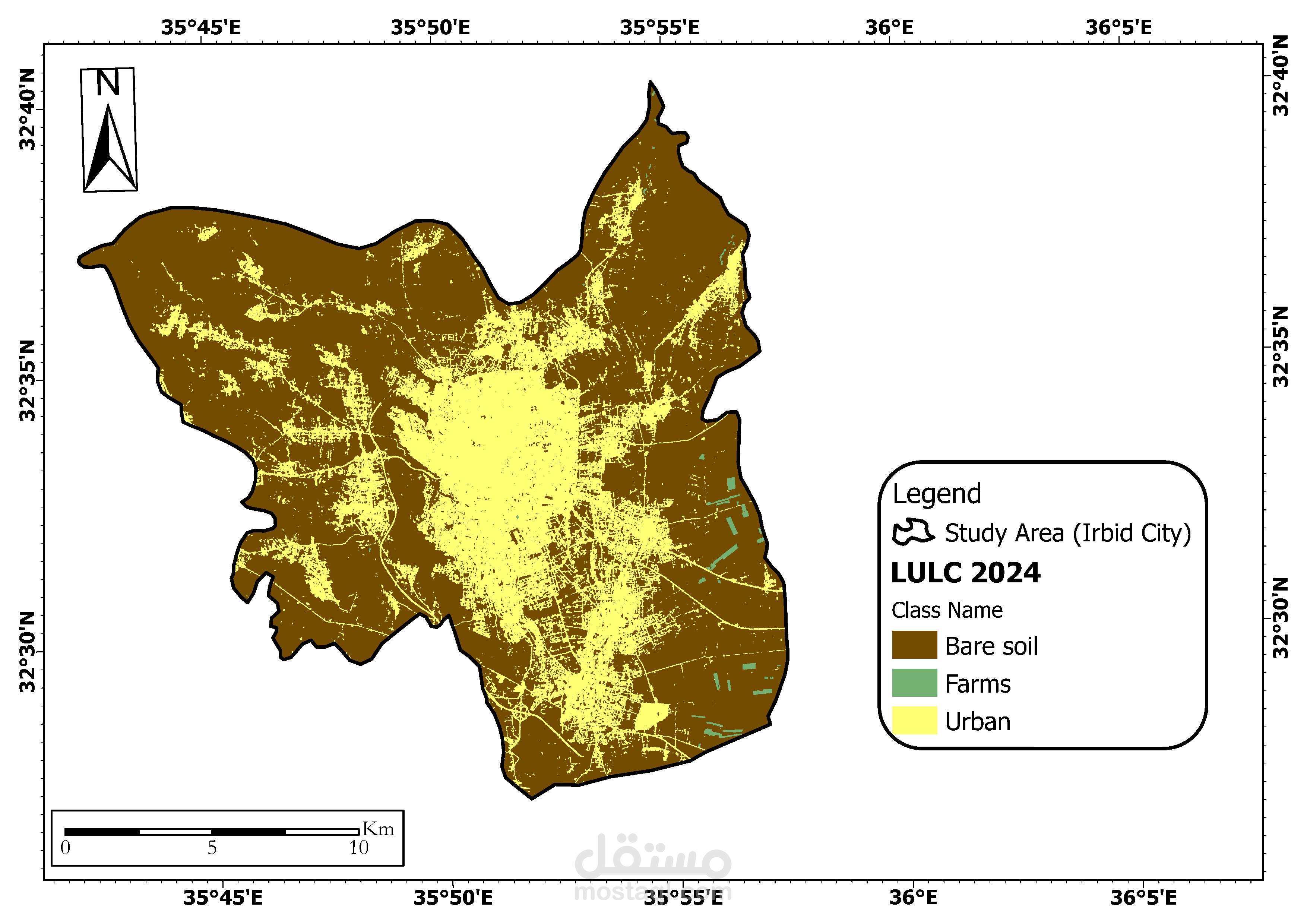
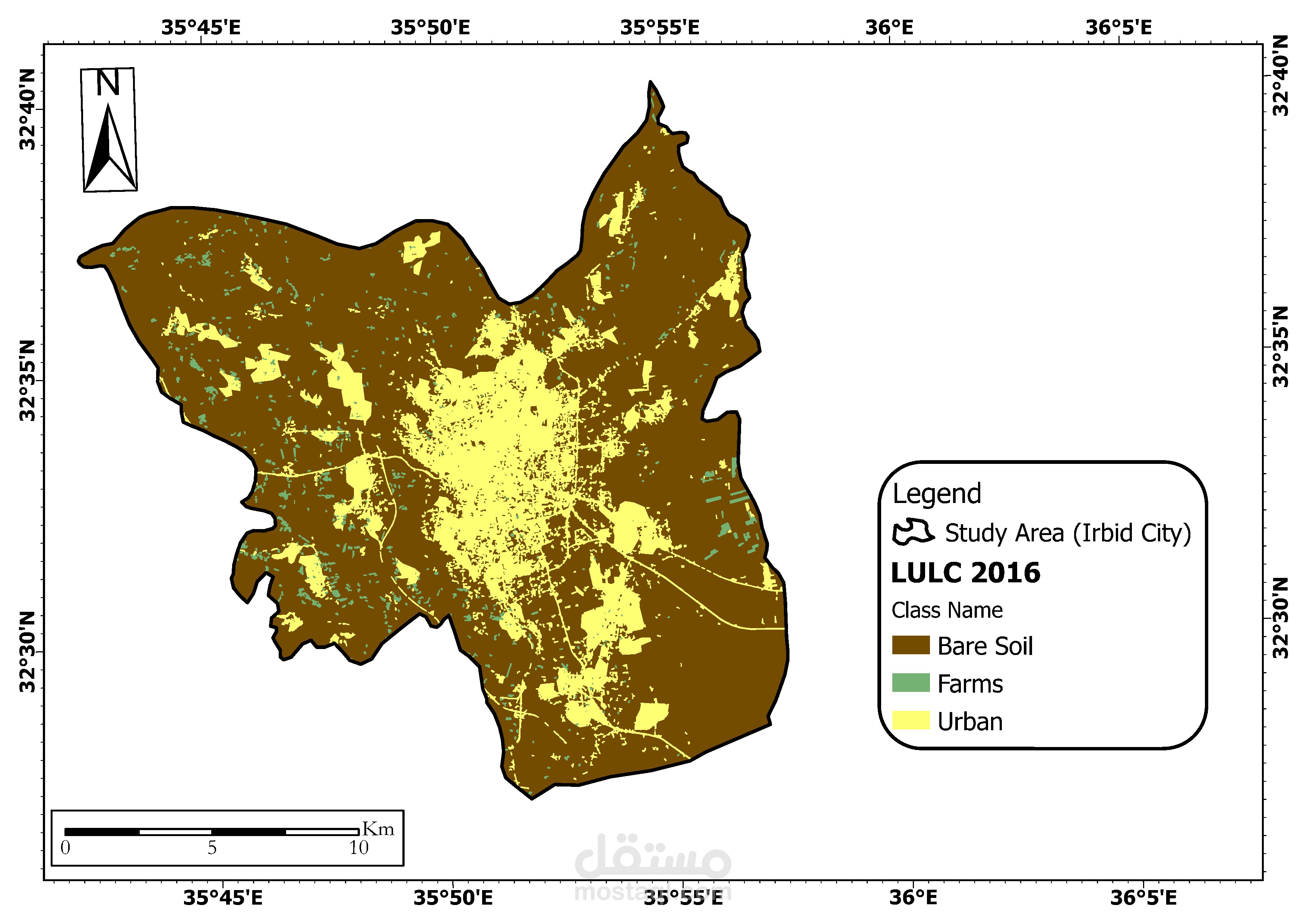
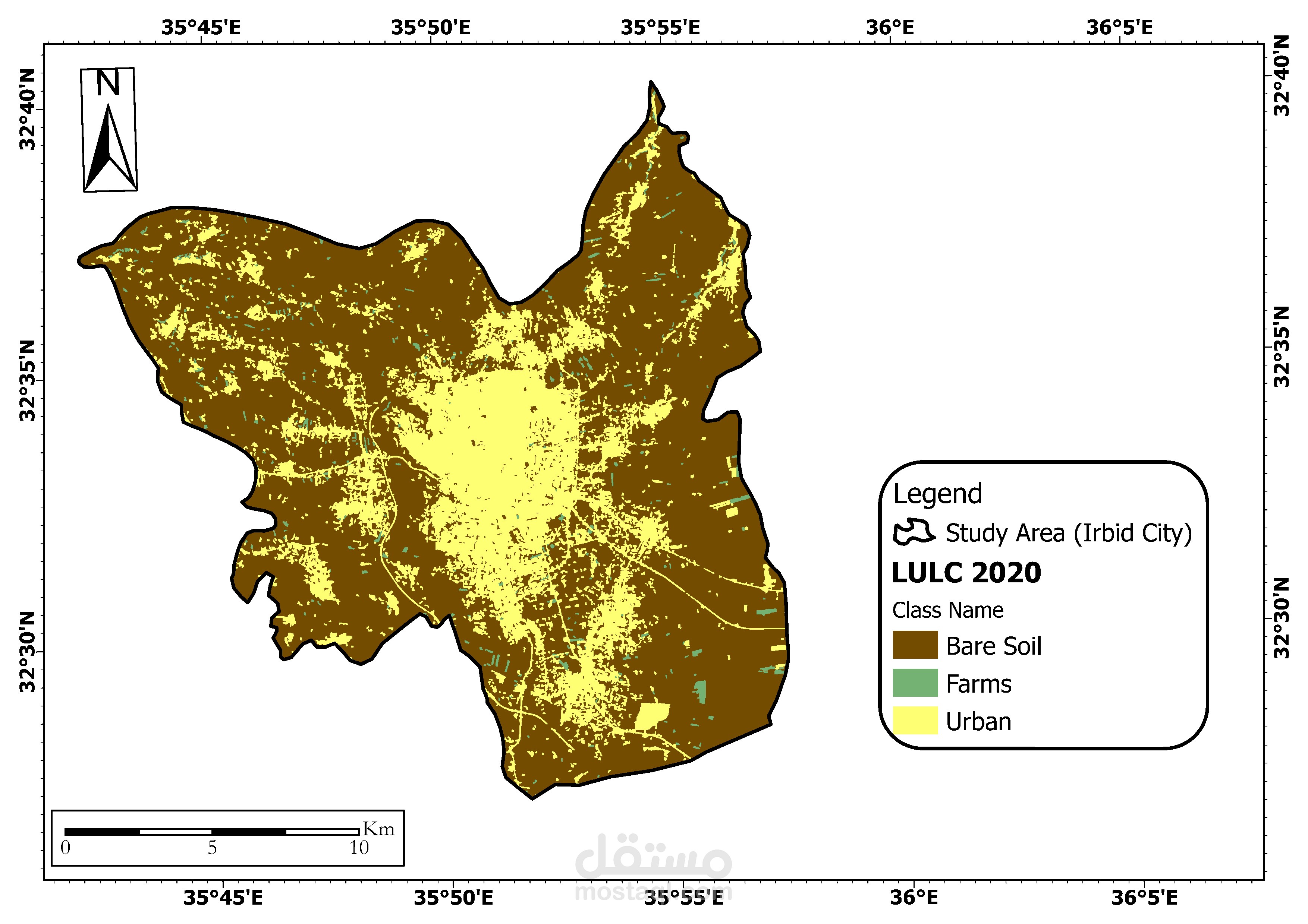
في هذا المشروع الأكاديمي، تم دراسة تأثير التوسع الحضري على الأراضي الزراعية في مدينة إربد باستخدام تقنيات الاستشعار عن بعد ونظم المعلومات الجغرافية (GIS). تم تطبيق مجموعة من الأساليب التحليلية على صور الأقمار الصناعية (Sentinel-2) للأعوام 2016، 2020، و2024 لرصد وتحليل تغيرات الغطاء الأرضي.
الأدوات والأساليب المستخدمة:
برمجيات التحليل: ArcMap
مصدر البيانات: Sentinel-2 من برنامج كوبرنيكوس الأوروبي
طرق التحليل: التصنيف الخاضع للإشراف باستخدام خوارزمية Random Forest، وتحليل التغير الزمني (Post-classification Change Detection)
أبرز النتائج:
ارتفعت المناطق الحضرية من 61.9 كم² في عام 2016 إلى 81.0 كم² في 2024.
انخفضت المساحات الزراعية بشكل حاد من 5.8 كم² إلى 1.1 كم² خلال نفس الفترة.
تراجع تدريجي في الأراضي المكشوفة (bare soil) من 247.7 كم² إلى 233.3 كم².
أهمية المشروع:
يُظهر المشروع بوضوح التأثير السلبي للتوسع العمراني غير المُنظَّم على الأراضي الزراعية، مما يشكل تهديدًا على الأمن الغذائي المحلي ويبرز الحاجة إلى تخطيط عمراني مستدام. كما يعكس المشروع كفاءة استخدام تقنيات الاستشعار عن بعد وGIS في تحليل التغيرات المكانية والزمنية ودعم اتخاذ القرار.
This academic project focused on assessing the impact of urban sprawl on agricultural land in Irbid City, Jordan, using advanced Remote Sensing and Geographic Information Systems (GIS) techniques. The study utilized Sentinel-2 satellite imagery from the years 2016, 2020, and 2024 to monitor land cover changes and detect urban growth patterns over time.
Tools and Methods:
Software: ArcMap
Data Source: Sentinel-2 imagery (Copernicus Open Access Hub)
Analysis Techniques: Supervised classification using the Random Forest algorithm, and post-classification change detection to quantify land transitions.
Key Findings:
Urban areas expanded significantly from 61.9 km² in 2016 to 81.0 km² in 2024.
Agricultural land drastically declined from 5.8 km² to just 1.1 km², indicating rapid urban encroachment.
Bare soil areas gradually decreased from 247.7 km² to 233.3 km² over the same period.
Project Significance:
This project clearly illustrates the negative consequences of unplanned urban expansion on agricultural zones, highlighting critical issues related to food security and sustainable land use. The results emphasize the importance of applying remote sensing and GIS tools for monitoring land cover dynamics and informing urban planning policies in rapidly developing cities.