Detection Land Cover change in the Al-Hosn – Irbid based on Remote Sensing Data for the period 1985 - 2023 ﺍﻟﻜﺸﻒ ﻋﻦ ﺍﻟﺘﻐﻴﺮ ﻓﻲ ﺍﻟﻐﻄﺎﺀ ﺍﻷﺭﺿﻲ ﻟﻤﻨﻄﻘﺔ ﺍﻟﺤﺼﻦ – ﺍﺭﺑﺪ ﺑﺎﻻﻋﺘﻤﺎﺩ ﻋﻠﻰ ﺑﻴﺎﻧﺎﺕ ﺍﻻﺳﺘﺸﻌﺎﺭ ﻋﻦ ﺑﻌﺪ ﺧﻼﻝ ﺍﻟﻔﺘﺮﺓ 1985 - 2023
تفاصيل العمل

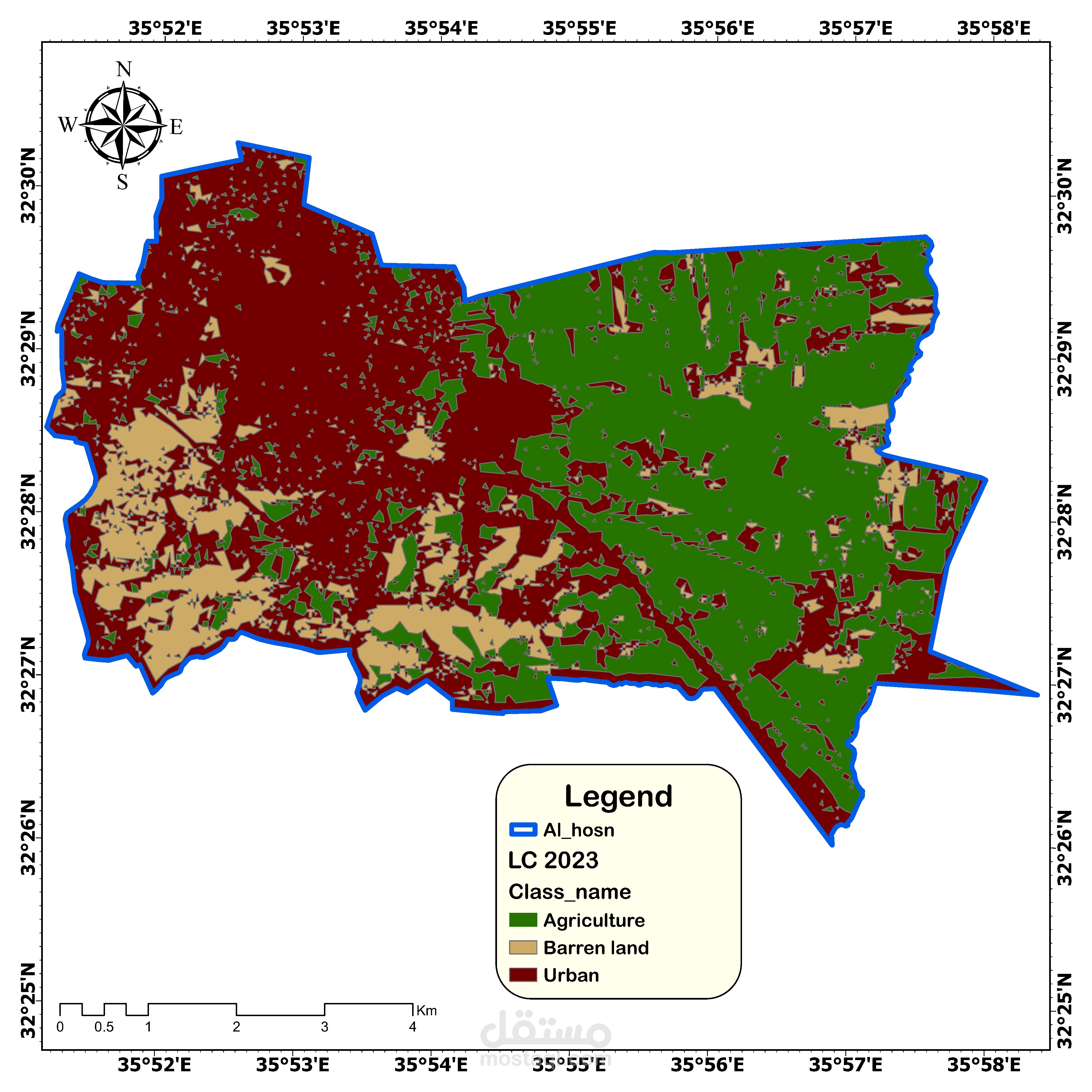
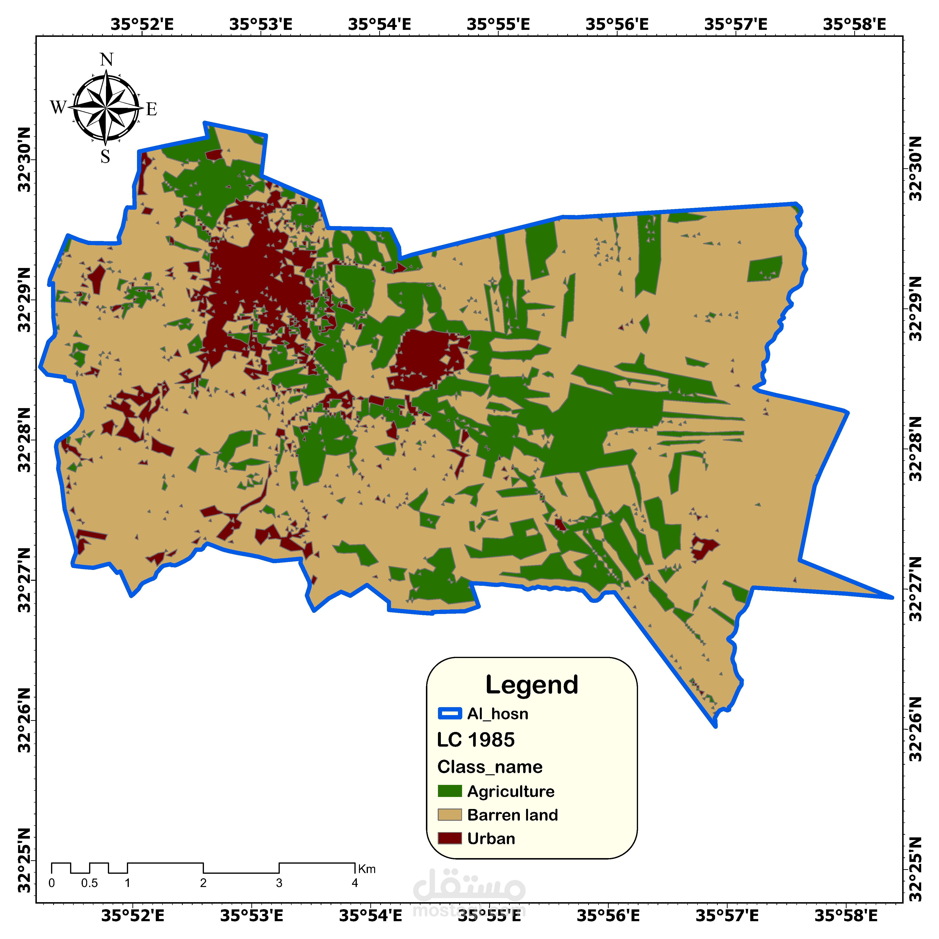
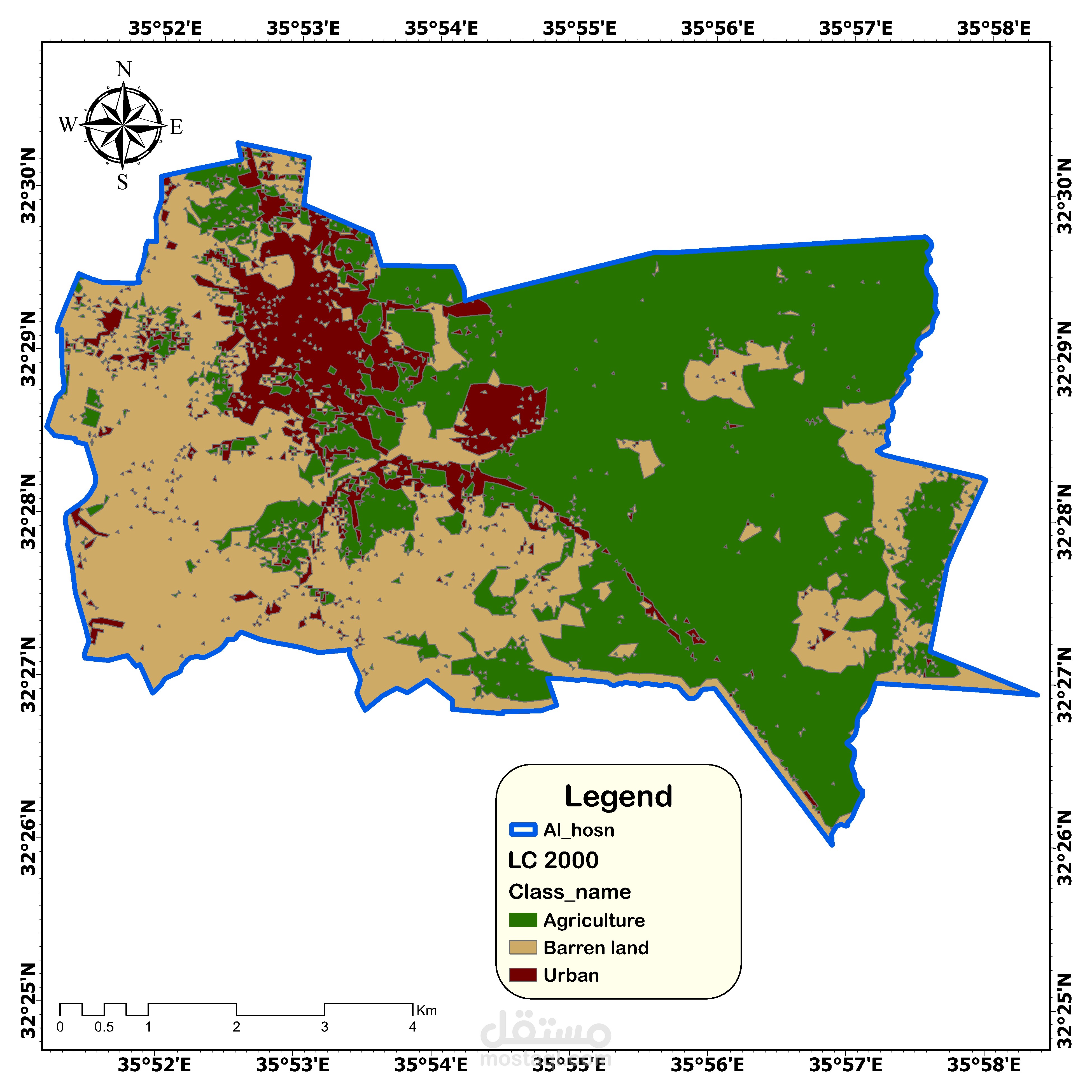
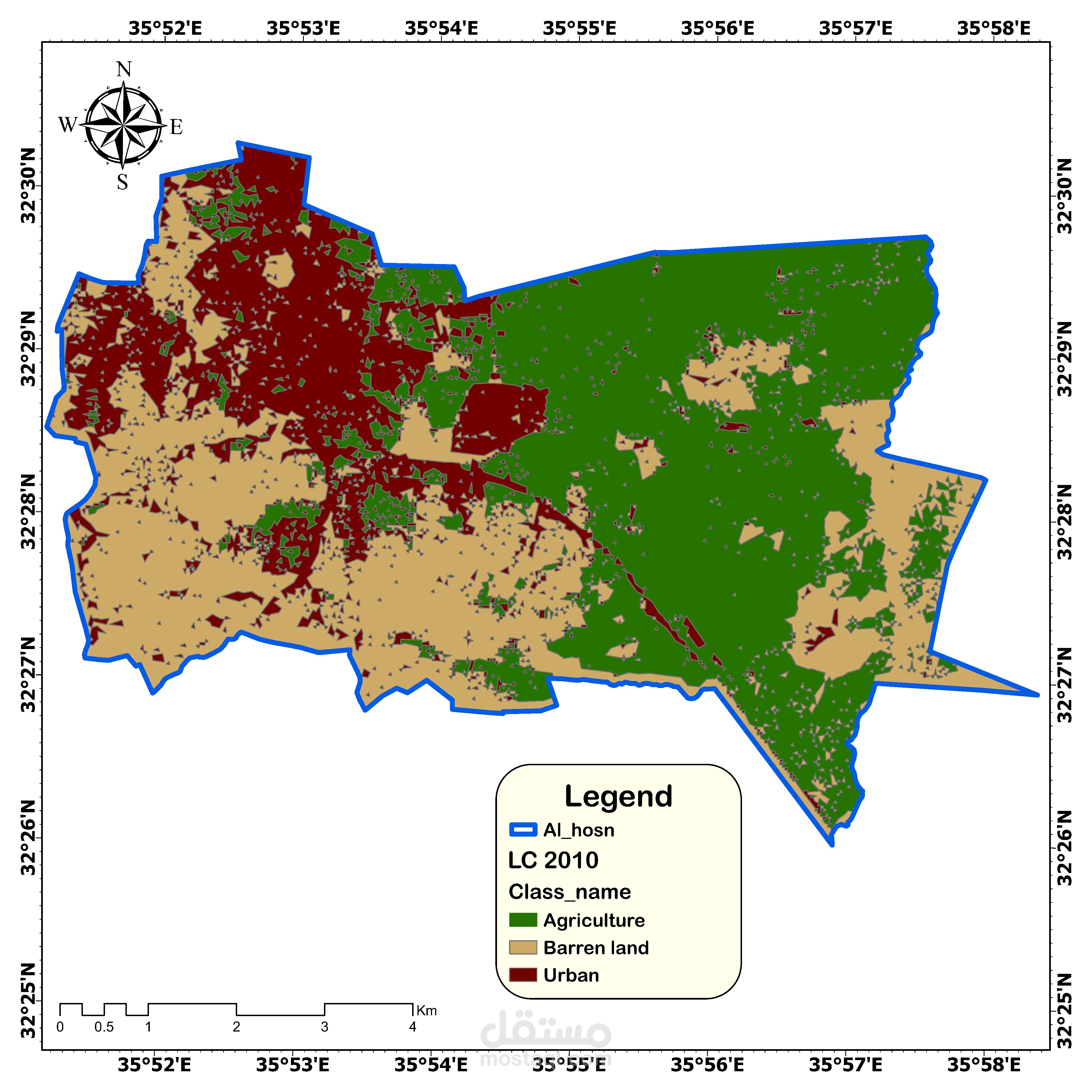
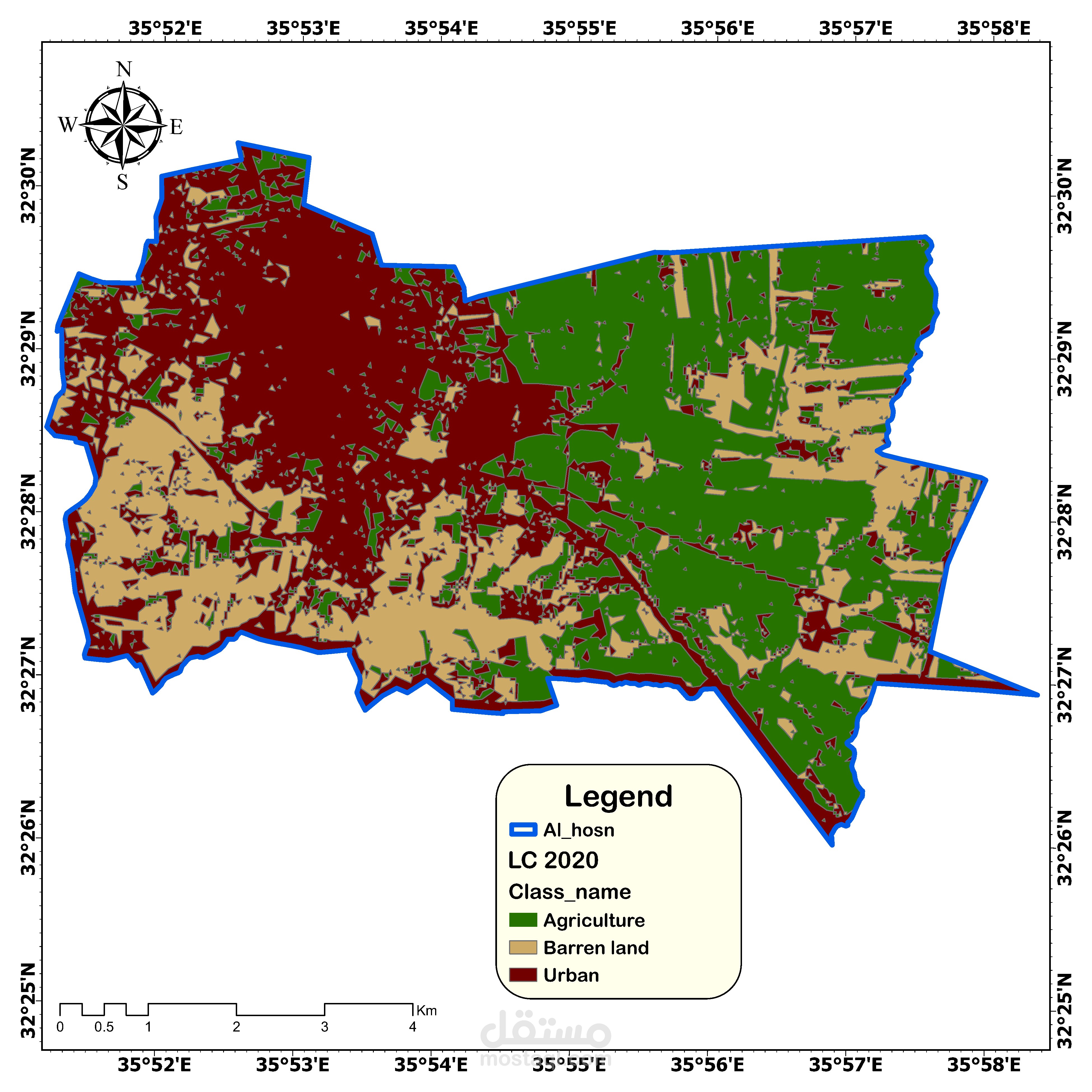
يهدف هذا البحث إلى دراسة التغير في الغطاء الأرضي لمنطقة الحصن بإربد خلال الفترة من 1985 إلى 2023 باستخدام بيانات الاستشعار عن بعد ونظم المعلومات الجغرافية. تم تحليل البيانات باستخدام طريقة التصنيف الموجه. أظهرت النتائج توسعًا ملحوظًا في المناطق الحضرية من 4.2 كم² في عام 1985 إلى 23.6 كم² في عام 2023، مع انخفاض كبير في الأراضي الجرداء. تعكس هذه التغيرات تأثير الأنشطة البشرية والنمو العمراني. يوصي البحث بتعزيز التخطيط العمراني المستدام وحماية الأراضي الزراعية من الزحف العمراني.
This research aims to study the land cover changes in the Al-Husn area in Irbid during the period from 1985 to 2023 using remote sensing data and geographic information systems. The data were analyzed using the vector classification method. The results showed a significant expansion of urban areas from 4.2 km² in 1985 to 23.6 km² in 2023, with a significant decrease in barren lands. These changes reflect the impact of human activities and urban growth. The research recommends promoting sustainable urban planning and protecting agricultural lands from urban sprawl.