Geo Web Application for Market Analytics
تفاصيل العمل
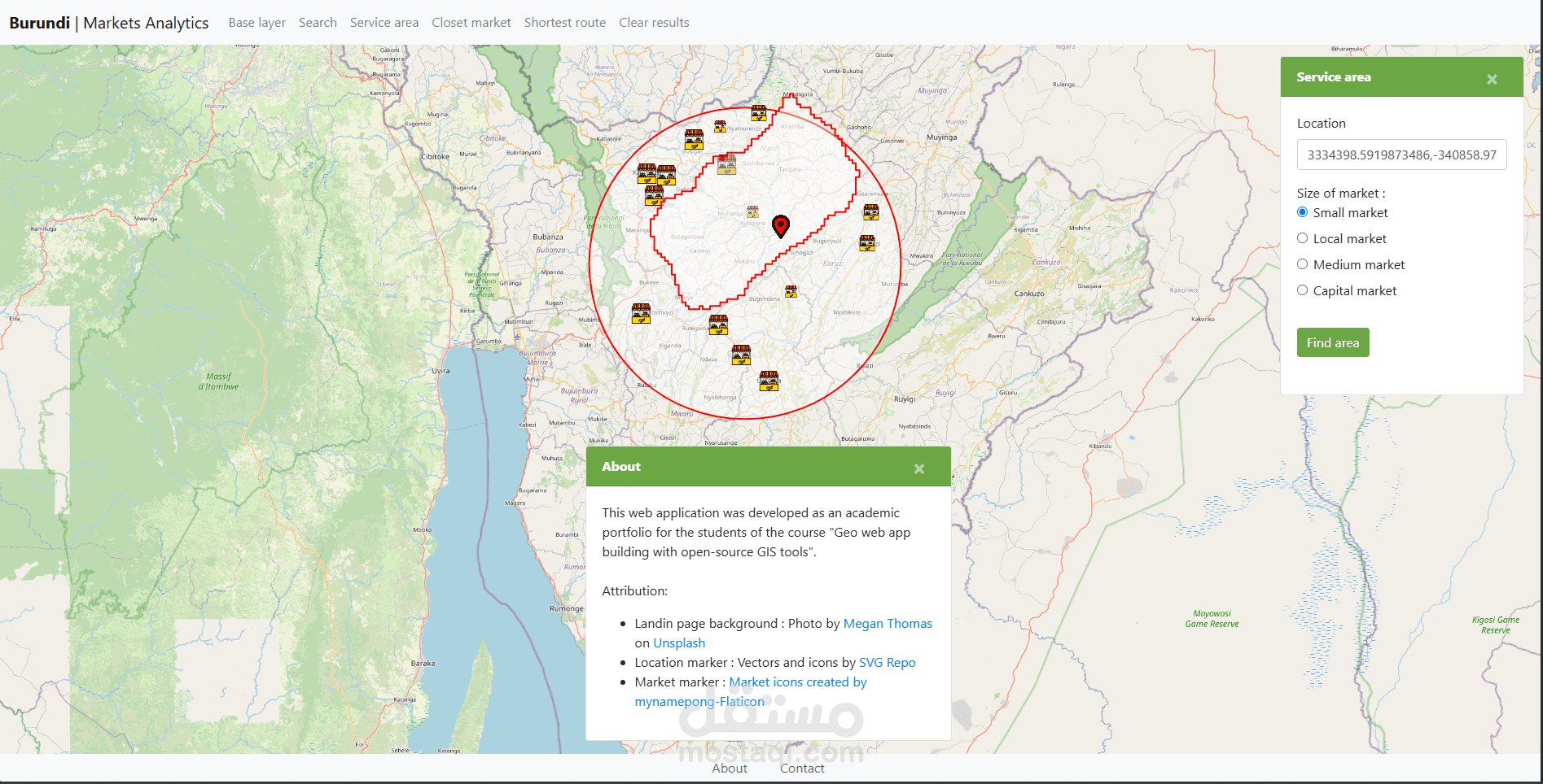
An interactive web-based GIS platform for exploring and analyzing market data across Burundi. The application includes spatial tools for visualizing market access, calculating routes, and identifying nearby markets to support logistics and decision-making.
Base Map Selector: Switch between various base maps (satellite, terrain, streets).
Service Area Tool: Visualize areas reachable from a location within a set distance/time.
Search Markets Tool: Find markets by name or attributes.
Shortest Route Tool: Calculate the optimal route between two points.
Closest Markets Tool: Find the nearest markets from a given location.