Full-Stack Web Mapping Application
تفاصيل العمل
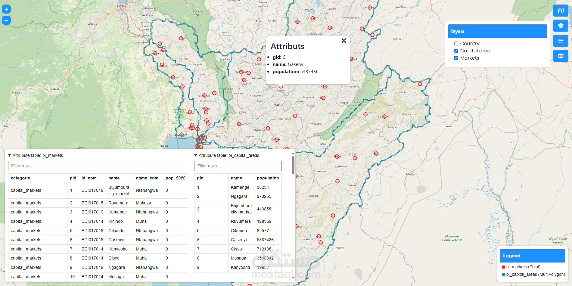
This is a full-stack web mapping application built with OpenLayers (frontend) and Flask (backend). It connects to a PostgreSQL/PostGIS database to fetch vector layers dynamically and displays them with interactive map features.
Features
Basemap Switcher — OpenStreetMap, OpenTopoMap, ESRI maps
Dynamic Layer Loading — load GeoJSON layers from a PostGIS database
Interactive Popups — show feature info on map click
Attribute Table — display and filter layer data in a collapsible table
Dynamic Legend — auto-generated color legend for each active layer