Survey Data Processing & Civil 3D Modeling for Road Design
تفاصيل العمل

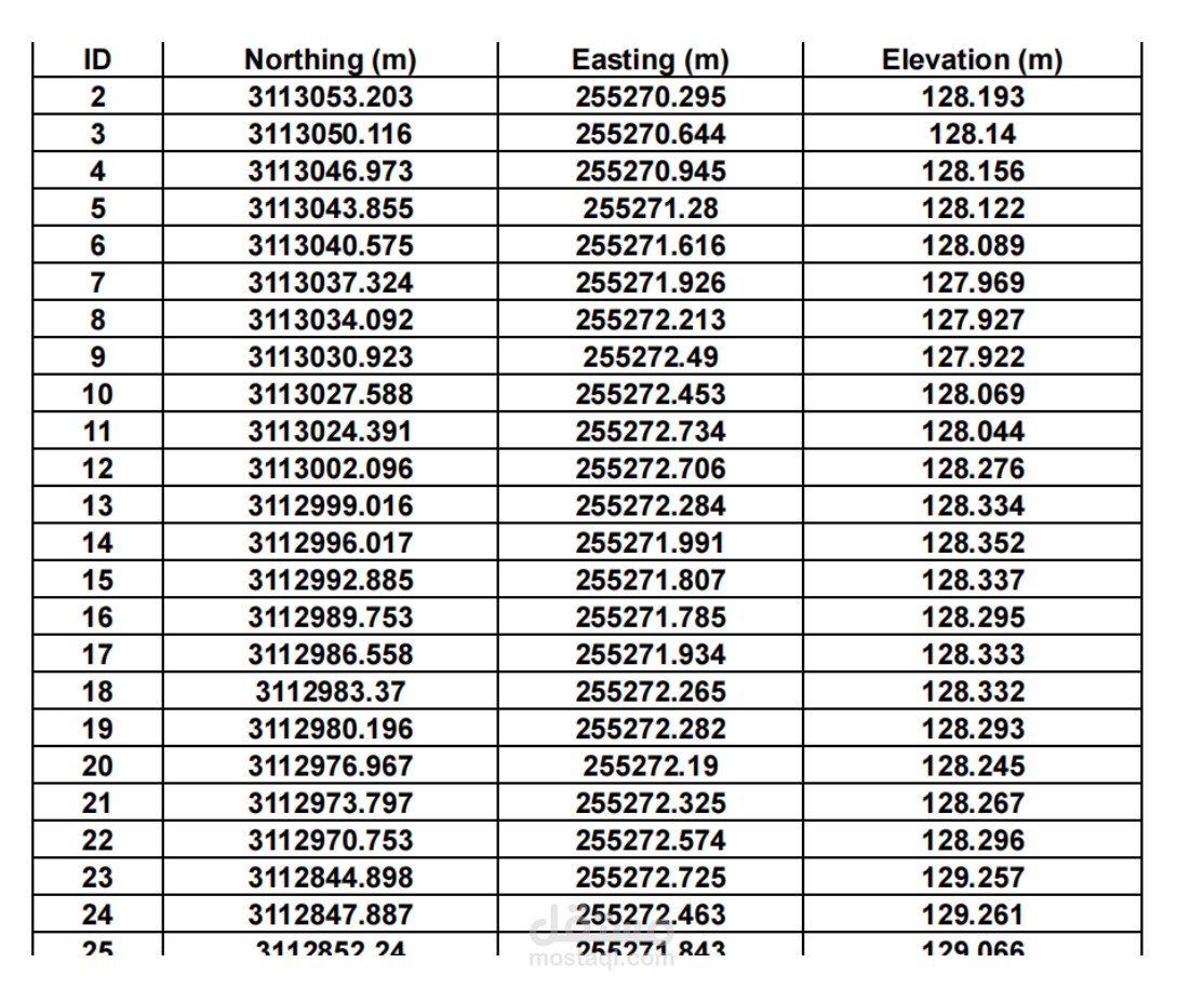
Imported and cleaned survey point data
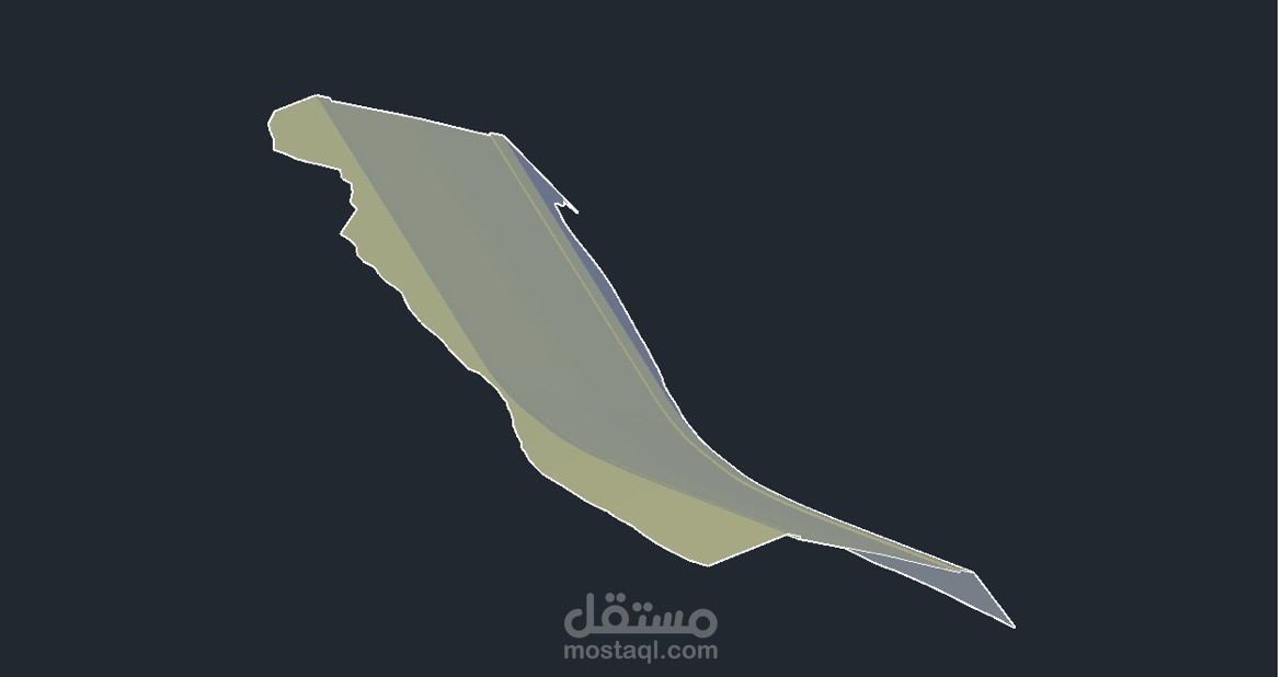
- Generated existing ground surfaces -
Extracted cross sections at regular chainages - Created longitudinal profiles
- Built Civil 3D model for proposed road alignment