Sentinel-Land-Classification with DNN
تفاصيل العمل


Overview
This project focuses on leveraging Deep Neural Networks (DNNs) to classify different land types (such as agriculture, water, urban areas, desert, roads, and trees) using satellite imagery from the Sentinel-2 mission by the European Space Agency (ESA). The goal is to build an accurate classification model that can be useful for applications like urban planning, environmental monitoring, and resource management.
Dataset
Source: Sentinel-2 satellite images
Alternative Dataset: EuroSAT Dataset
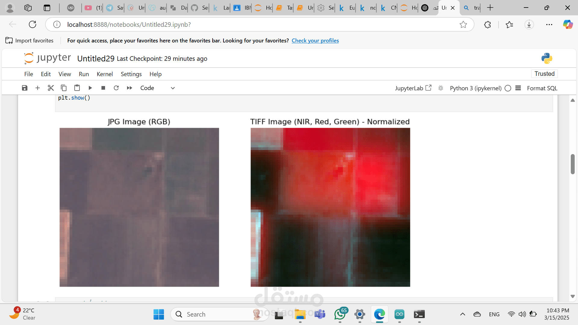
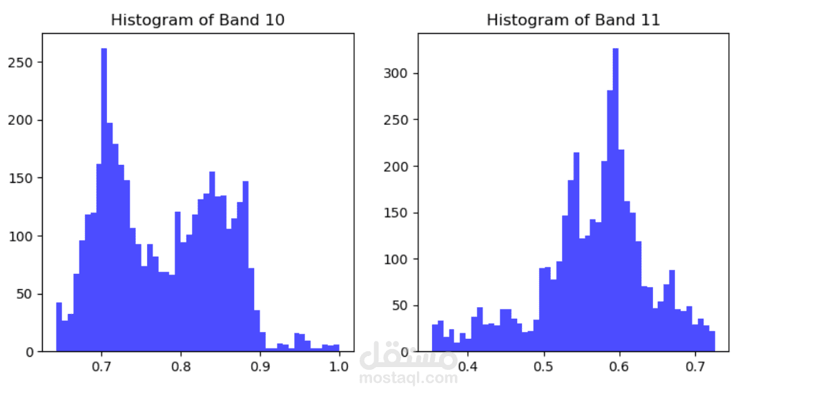
Image Type: Multispectral images with different spectral bands (Red, Green, Blue, Near-Infrared, etc.)
Preprocessing: Resized, normalized, and enhanced using various techniques (e.g., atmospheric correction)
Project Milestones
1. Data Collection, Exploration & Preprocessing
Download Sentinel-2 images for the target region (e.g., Egypt) from Copernicus Open Access Hub
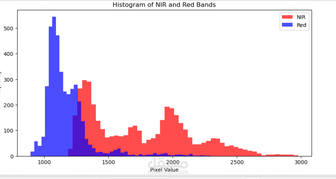
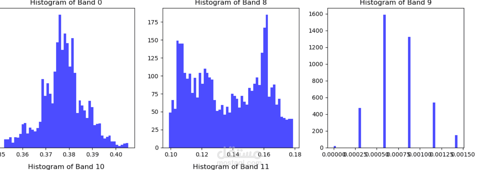
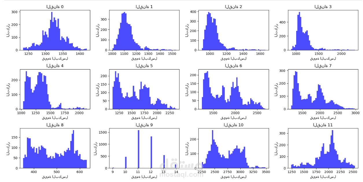
Perform Exploratory Data Analysis (EDA) to understand image composition and band relevance
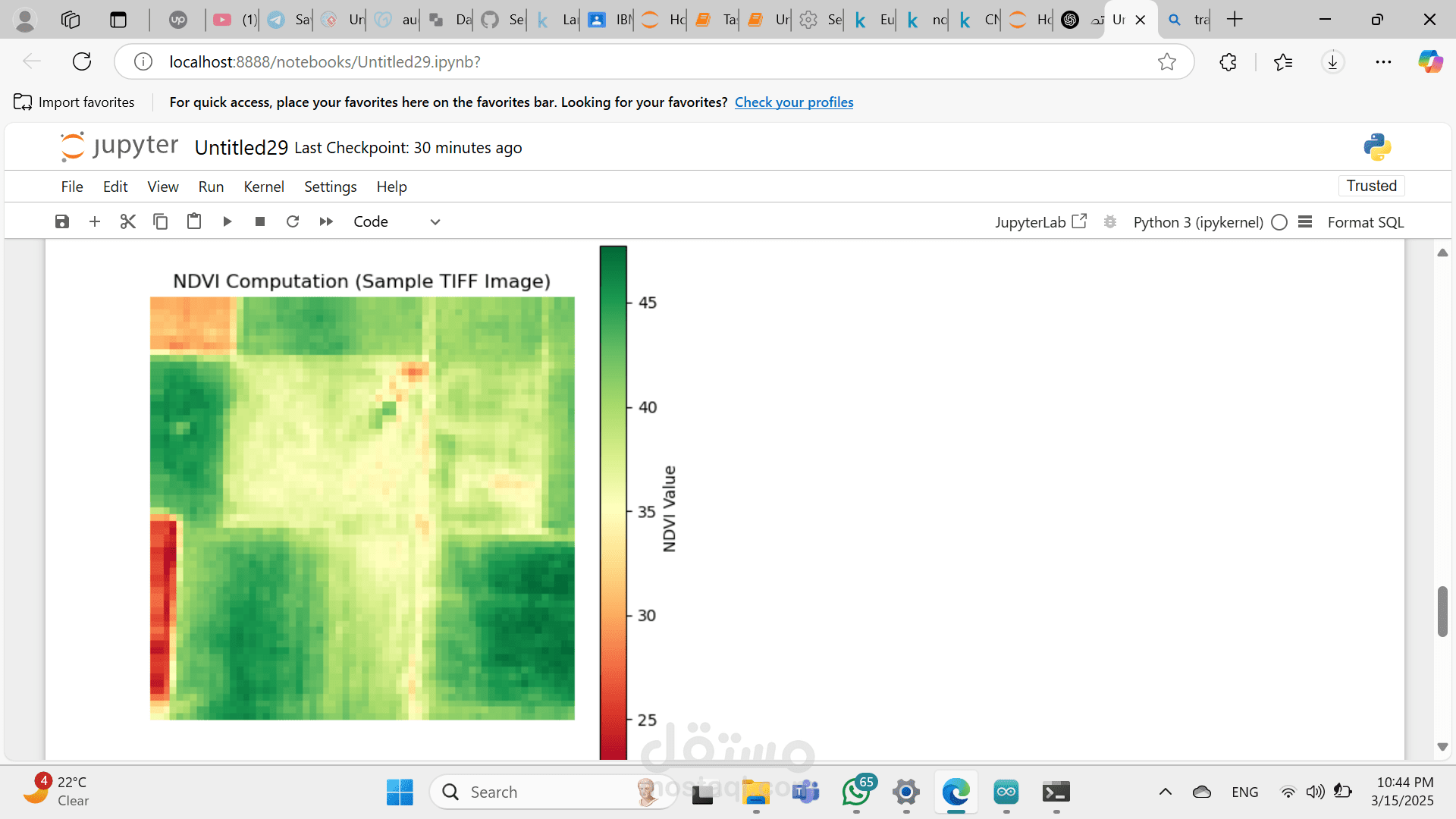
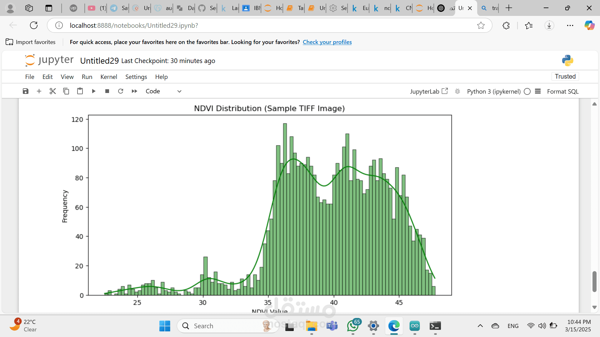
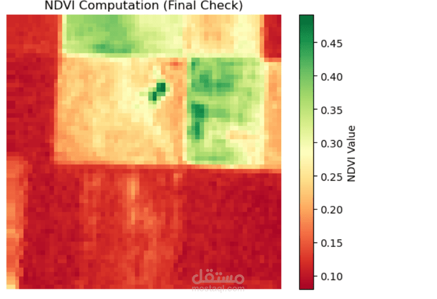
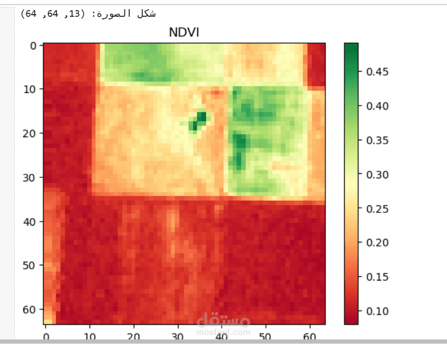
Preprocess the dataset (resizing, band selection, image augmentation, and NDVI calculation)
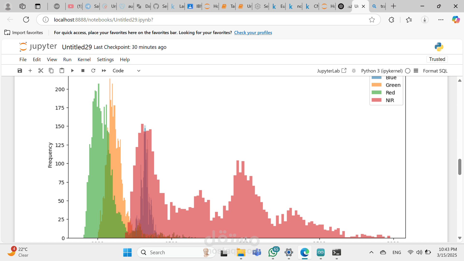
Visualize spectral signatures of different land types
2. Advanced Data Analysis & Model Selection
Identify key spectral bands that influence land classification
Perform Principal Component Analysis (PCA) to reduce dimensionality
Experiment with various Deep Learning models, starting with CNNs (Convolutional Neural Networks)
Consider transfer learning using pre-trained models (e.g., ResNet, VGG, or U-Net)
3. Model Development & Training
Implement CNN-based DNN models using TensorFlow/Keras or PyTorch
Train the model with early stopping and hyperparameter tuning
Evaluate performance using metrics like accuracy, precision, recall, and F1-score
Visualize results using confusion matrices and activation maps
4. Deployment & Monitoring
Deploy the model as a web service/API using Flask or FastAPI
Monitor classification accuracy and detect model drift over time
Implement a strategy for periodic retraining with new satellite images
Installation & Usage
Requirements
Python 3.8+
TensorFlow / PyTorch
NumPy, Pandas, Matplotlib, Seaborn
OpenCV, Rasterio (for image processing)
Flask / FastAPI (for deployment)