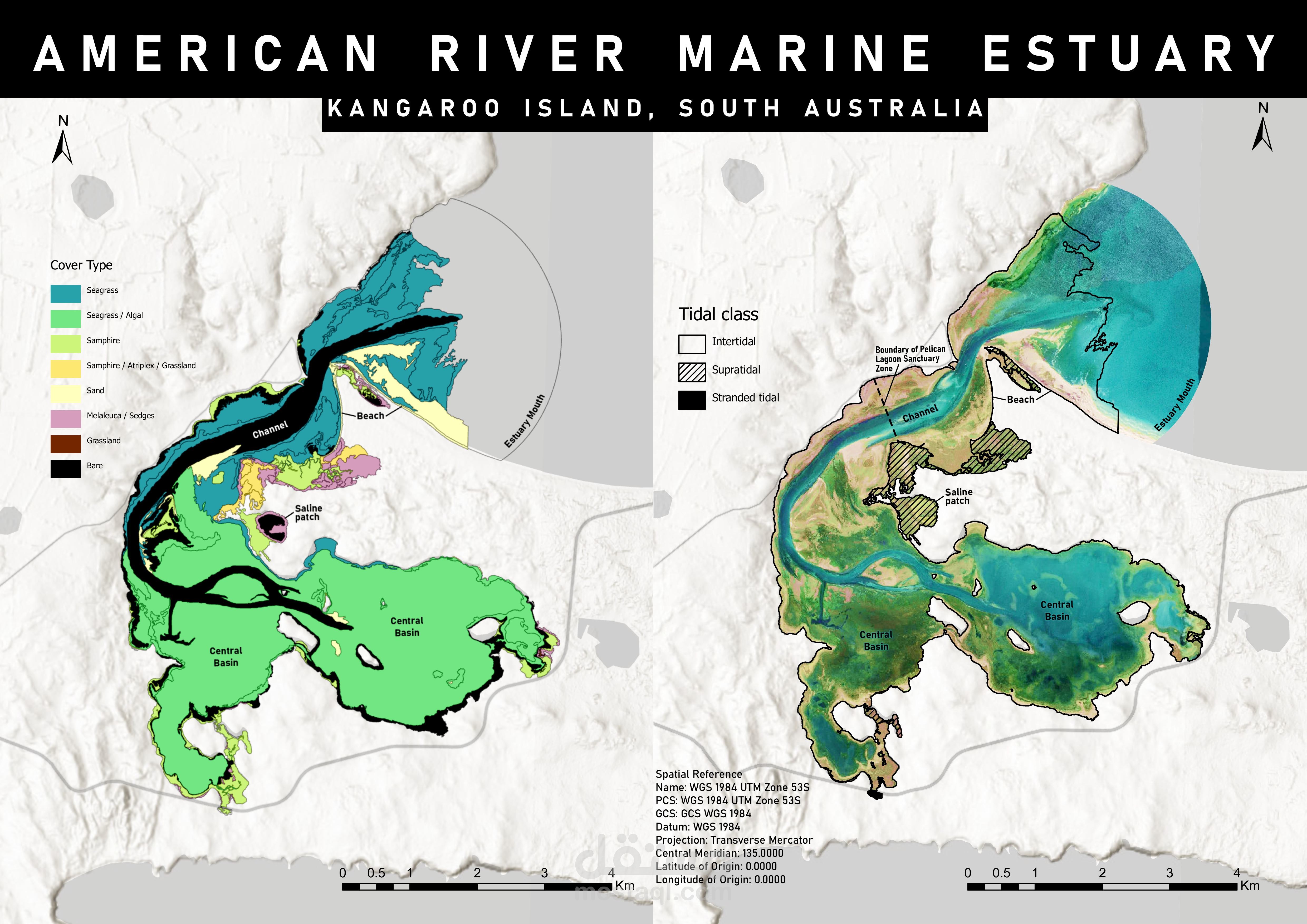
American River Marine Estuary: Spatial Analysis of Cover Types and Tidal Classes on Kangaroo Island, South Australia.
تفاصيل العمل
This project involves a geospatial analysis of the American River Marine Estuary on Kangaroo Island, South Australia. The analysis includes the classification of cover types, such as grasslands, bare ground, and seagrasses, and the mapping of tidal zones (stranded tidal, supratidal, and intertidal) using the WGS 1984 UTM Zone 53S spatial reference. The work supports environmental conservation efforts and habitat mapping within the Pelican Lagoon Sanctuary Zone
