Moving Valmeyer
تفاصيل العمل
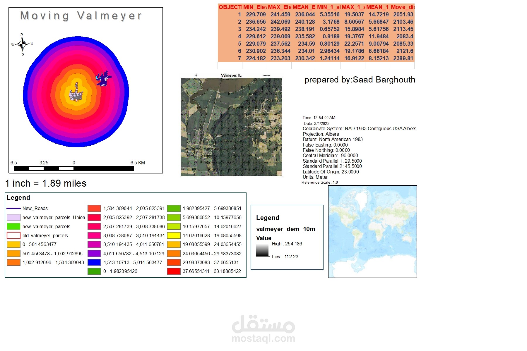
A town by name Valmeyer in Monroe county took a major decision of moving the entire town from one location to another in order to mitigate its risk disasters that cost lives and properties from flood in the Mississippi River floodplain. As a GIS AnaIyst, I have been tasked to manage and maintain a GIS layer of parcel information, which describes property boundaries and locations. I have an old and a new parcels layer. The new parcels layer needs to be updated with current data so it can be compared to the old data. The data I will need to attach as new attributes to the parcels layers includes: • The mean, minimum, and maximum elevation of each parcel • The mean, minimum, and maximum slope, in degrees, of each parcel I will also need to add the mean distance to the location of the old town, in meters – this will help the office of emergency management understand what is involved in these types of town relocations. Web Map produced shows the relocation of Valmeyer IL . The new town parcel and geographic information is updated. The new layer information include parcel elevation, slope, and distance from the ol